Showing 37–48 of 431 results
-

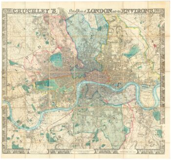
A superb wall map of London in the mid 19th century
£9,000CRUCHLEY, George Frederick.
Published In 1847
Stock No. 23305 -

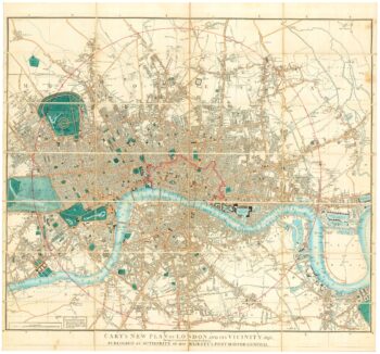
Detailed map of London in the reign of William IV
£1,500CARY, John.
Published In 1836
Stock No. 23294 -

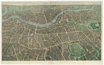
A bird’s-eye view of London from the north
£5,500BANKS, John Henry.
Published In 1851
Stock No. 18604 -

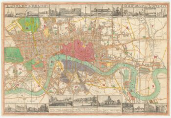
Town plan of Georgian London with illustrated borders
£2,800LANGLEY & BELCH.
Published In 1816
Stock No. 18491 -

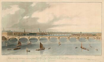
A prospect of the new Waterloo Bridge
£2,200ANDERSON, William.
Published In 1822
Stock No. 18488 -

Map of London’s Underground as run by separate companies
£650GILL, Leslie MacDonald.
Published In 1923
Stock No. 24033 -

Covent Garden and Soho from an important large-scale survey of London
£1,600HORWOOD, Richard.
Published In 1799
Stock No. 24405 -

St James’s from an important large-scale survey of London
£1,500HORWOOD, Richard.
Published In 1795
Stock No. 24402 -

Knightsbridge from an important large-scale survey of London
£1,500HORWOOD, Richard.
Published In 1794
Stock No. 24401 -

Pimlico and Belgravia from an important large-scale survey of London
£700HORWOOD, Richard.
Published In 1799
Stock No. 24400 -

An early example of this 17th century map of Lithuania
£1,200HONDIUS, Henricus.
Published In 1640
Stock No. 24390 -

A view of the Great Fire of London, 1666
£980MERIAN, Matthaus.
Published In 1690
Stock No. 24367