- Reset all
- Africa Continent
- Bering Strait
- Bermuda
- Black Sea
- Books about Maps
- Calabria
- Cambridgeshire
- Campania
- Crete
- Europe
- Hispaniola
- Hungary
- Iceland
- India
- Ireland
- Italy
- Latvia and Estonia
- London Environs
- Marche
- Maritime
- Mexico
- Monaco
- Near East
- North Africa Maps
- North America
- Oxfordshire
- Pacific and Australasia
- Pennsylvania
- Pictorial Maps
- Poland
- Prints
- Provence
- Russia
- Scientific Instruments
- Somerset
- Staffordshire
- Surrey
- Syria
- United States Maps
- Worcestershire
- Yorkshire
Showing 1417–1428 of 1432 results
-

Denmark Jutland
£225DE WIT, Frederick.
Published In 1688
Stock No. 7706 -

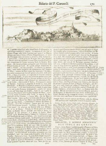
Corfu City
£120CORONELLI, Vincenzo Maria.
Published In 1696
Stock No. 7629 -

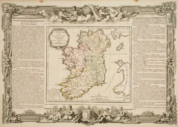
18th century decorative map of Ireland
£260BRION DE LA TOUR, Louis.
Published In 1766
Stock No. 7547 -

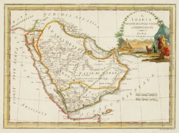
18th century Italian map of Arabia
£750CASSINI, Giovanni Maria.
Published In 1797
Stock No. 7500 -

An uncommon sea chart of France’s Mediterranean coast
£300LEVANTO, Francesco Maria.
Published In 1696
Stock No. 7408 -

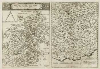
A scarce 16th century map of Piedmont and Berry
£1,100DE JODE, Gerard.
Published In 1593
Stock No. 7395 -

Rare map of the Bering Strait
£350CASSINI, Giovanni Maria.
Published In 1798
Stock No. 7375 -

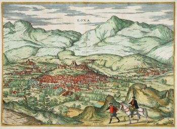
Early prospect of Loja
£325BRAUN, Georg & HOGENBERG, Frans.
Published In 1575
Stock No. 7340 -

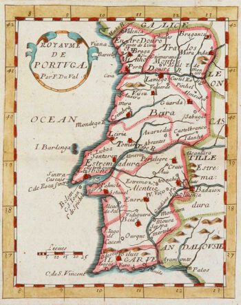
Miniature map of Portugal
£100DU VAL, Pierre.
Published In 1680
Stock No. 8134 -

17th century map of Portugal
£300DE WIT, Frederick.
Published In 1688
Stock No. 7672 -

17th century map of the North Riding of Yorkshire in fine colour
£650BLAEU, Johannes.
Published In 1662
Stock No. 23040 -

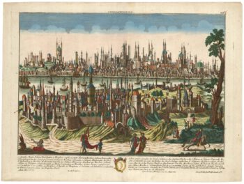
An 18th century prospect of Constantinople
£1,250PROBST, Georg Matthaus.
Published In 1780
Stock No. 23037