Showing 1–12 of 57 results
-

London in the reign of William IV
£550SMITH, Charles.
Published In 1836
Stock No. 24428 -

Two-sheet map of Africa
£1,200JAILLOT, Alexis-Hubert.
Published In 1705
Stock No. 24063 -

Early 19th century plan of London
£350Anonymous.
Published In 1810
Stock No. 24505 -

A Victorian plan of London
£750WYLD, James.
Published In 1859
Stock No. 23945 -

A mid-19th century map of Africa with vignettes
£250TALLIS, John.
Published In 1851
Stock No. 23542 -

The first English atlas map of Africa
£2,600SPEED, John.
Published In 1665
Stock No. 23984 -

Victorian map of the environs of London
£220MOULE, Thomas.
Published In 1837
Stock No. 23574 -

A previously unrecorded carte-à-figures map of Africa
£5,000TODESCHI, Pietro.
Published In 1670
Stock No. 24121 -

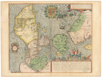
A superb 16th century map of Denmark
£2,000JORDAN, Mark.
Published In 1588
Stock No. 23838 -

Mid-Victorian wall map of London on a scale of 6” to a Mile
£3,500STANFORD, Edward.
Published In 1861
Stock No. 23419 -
The first issue of this 16th century map of Africa
£1,500MERCATOR, Gerard II.
Published In 1595
Stock No. 23299 -

A separately-issued map of Denmark, the earliest dated map by de Wit
£750DE WIT, Frederick.
Published In 1659
Stock No. 23255