- Reset all
- Africa
- Andalusia
- Antarctic
- Antigua
- Bahamas
- Benelux
- Berkshire
- Bohemia
- British Islands
- Calabria
- Caspian Sea
- Central America
- China
- Europe
- Falklands
- Hertfordshire
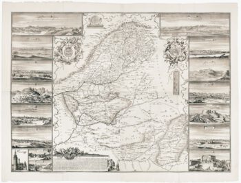
- Holy Land
- Latvia and Estonia
- Liguria
- Luxembourg
- Monaco
- New York
- North Africa
- Northern Italy
- Nottinghamshire
- Sardinia
- Scandinavia
- Scientific Instruments
- Sweden
- Texas
- The Guianas
- Tibet
- Trentino
- West Indies
- Western Europe
- Wiltshire
Showing 1153–1164 of 1252 results
-

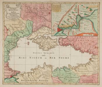
Map of the Black Sea in original colour
£580LOTTER, Tobias Conrad.
Published In 1760
Stock No. 12175 -

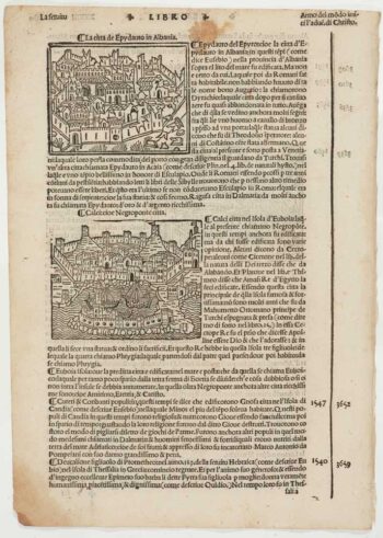
Early 16th century prospect of Athens
£120FORESTI, Giacomo.
Published In 1503
Stock No. 12059 -

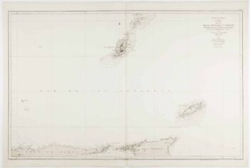
An uncommon 19th century Spanish sea chart of Grenada and Tobago
£800BREGANTE, S.
Published In 1868
Stock No. 11824 -

A decorative four-sheet map of France in fine colour
£2,000INSELIN, Charles.
Published In 1713
Stock No. 11666 -

Scarce four-sheet map of the Community of Madrid
£5,000LEONARDO, Juan Francisco.
Published In 1687
Stock No. 11652 -

A scarce bird’s-eye view of Paris
£1,200Anonymous.
Published In 1680
Stock No. 11573 -

Russia at the beginning of the reign of Peter the Great
£825DU VAL, Pierre.
Published In 1686
Stock No. 11447 -

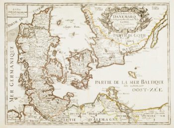
17th century French map of Denmark
£200DU VAL, Pierre.
Published In 1686
Stock No. 11443 -

Two-sheet map of the Russian Empire
£1,200MANNERT, Konrad.
Published In 1794
Stock No. 11414 -

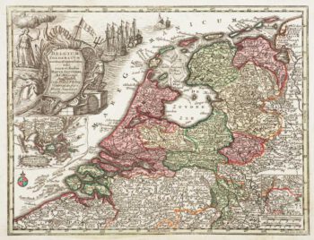
Holland with an Inset of its colonies in the East Indies
£280SEUTTER, Matthaus.
Published In 1744
Stock No. 11407 -
An early 17th century miniature map of Russia
£200BERTIUS, Petrus.
Published In 1603
Stock No. 11401 -

Luxembourg
£150SEUTTER, Matthaus.
Published In 1744
Stock No. 11397