Showing 37–48 of 171 results
-

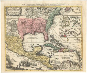
The European colonies in North America in the 18th century
£1,400SEUTTER, Matthaus.
Published In 1735
Stock No. 24089 -

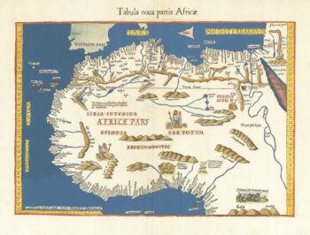
A famous 16th century woodblock map of North Africa
£850WALDSEEMULLER, Martin.
Published In 1541
Stock No. 23837 -

A miniature map of Mahe
£190WATERLOW & SONS LTD
Published In 1900
Stock No. 23635 -

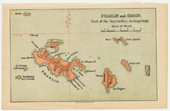
A miniature map of the northern Seychelles islands.
£175WATERLOW & SONS LTD
Published In 1900
Stock No. 23633 -

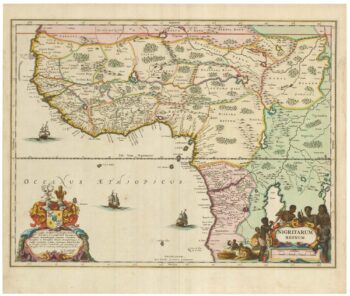
A 17th century old map of the Gulf of Guinea in West Africa
£500JANSSON, Jan.
Published In 1680
Stock No. 23630 -

Map of Peru and Bolivia with vignette scenes
£140TALLIS, John.
Published In 1851
Stock No. 23528 -

A mid 19th century map of West Canada with vignettes
£160TALLIS, John.
Published In 1851
Stock No. 23498 -

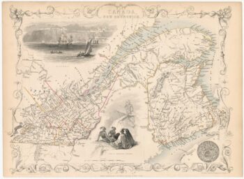
Map of Eastern Canada with vignettes
£150TALLIS, John.
Published In 1851
Stock No. 23482 -

A Dutch edition of rhe first printed map to accurately plot the Mississippi River
£1,700DELISLE, Guillaume.
Published In 1722
Stock No. 23463 -
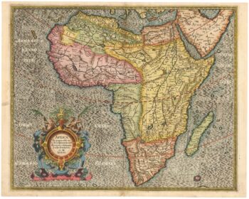
The first issue of this 16th century map of Africa
£1,500MERCATOR, Gerard II.
Published In 1595
Stock No. 23299 -

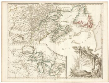
A late 18th century map of Canada and the Great Lakes
£550ROBERT DE VAUGONDY, Didier.
Published In 1793
Stock No. 23279 -

Decorative map of Egypt and the Nile
£450HOMANN, Johann Baptist.
Published In 1725
Stock No. 23263