Showing 85–96 of 120 results
-

Handkerchief published to raise money for the families of Boer War Soldiers
£380DAILY MAIL PUBLISHING.
Published In 1899
Stock No. 17963 -

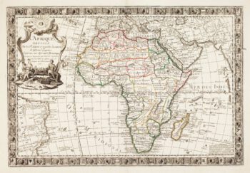
18th century map of Africa
£190WEIGEL, Christoph.
Published In 1720
Stock No. 17829 -

Maps of Bermuda and other islands in the Atlantic
£100TALLIS, John.
Published In 1851
Stock No. 17752 -

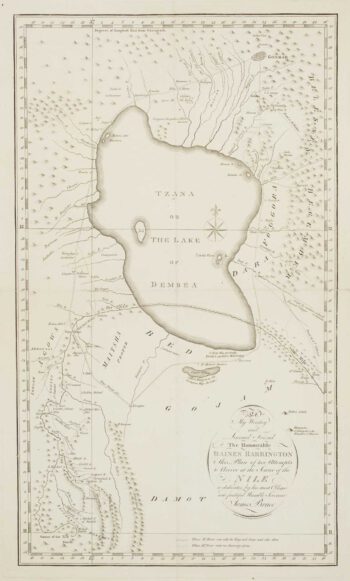
Bruce’s search for the source of the Nile
£450BRUCE, James.
Published In 1790
Stock No. 17095 -

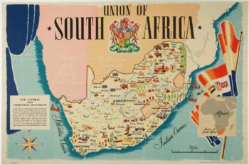
A pictorial map of South Africa from the Second World War
£650ANDERSON, W.
Published In 1943
Stock No. 16656 -

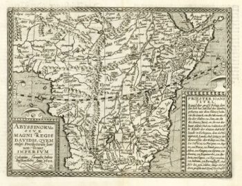
Map of Abyssinia with the Kingdom of Prester John
£500QUAD, Matthias.
Published In 1600
Stock No. 18351 -

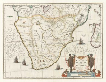
17th century map of Southern Africa
£765BLAEU, Willem Janszoon.
Published In 1665
Stock No. 17998 -

A scarce French map of Africa
£2,200DANET, Guillaume.
Published In 1760
Stock No. 16496 -
Map of north west Africa with vignettes
£95TALLIS, John.
Published In 1851
Stock No. 16151 -

Map of the Orange Free State published the day before the start of the Second Boer War
£375STANFORD, Edward.
Published In 1899
Stock No. 15864 -

View of Monte Carlo from an important topographical work
£450HARDING, James Duffield.
Published In 1836
Stock No. 15831 -

Mortier’s sea chart of Madagascar in full original colour
£1,100MORTIER, Pierre.
Published In 1700
Stock No. 14518