Showing 1–12 of 146 results
-

A 16th century woodcut map of Poland, Lithuania and Hungary
£700MUNSTER, Sebastian.
Published In 1572
Stock No. 24574 -

A scarce 18th century map of the Polish-Lithuanian Commonwealth
£950NOLIN, Jean Baptiste jnr.
Published In 1742
Stock No. 24544 -

A 17th century map of Poland
£750DE ROSSI, Giovanni Giacomo.
Published In 1685
Stock No. 24518 -

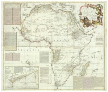
An 18th century wall map of Africa
£2,000ANVILLE, Jean Baptiste B. D'.
Published In 1772
Stock No. 24498 -

Four scarce Italian playing cards depicting Poland
£850Anonymous.
Published In 1790
Stock No. 24241 -

Ortelius’s map of Barbary in fine colour
£600ORTELIUS, Abraham.
Published In 1603
Stock No. 23807 -

16th century woodblock map of Silesia
£300MUNSTER, Sebastian.
Published In 1572
Stock No. 24582 -

A 16th century town plan of Tangier
£220VALEGIO, Francesco.
Published In 1598
Stock No. 24217 -

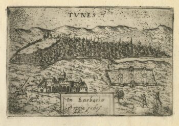
A 16th century town plan of Tunis
£160VALEGIO, Francesco.
Published In 1598
Stock No. 24216 -

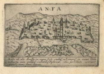
A 16th century town plan of Casablanca
£240VALEGIO, Francesco.
Published In 1598
Stock No. 24215 -

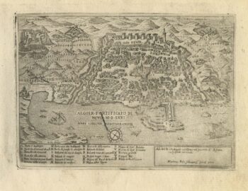
A 16th century town plan of Algiers
£150ROTA, Martin.
Published In 1598
Stock No. 24214 -
A 16th century town plan of Kilwa Kisiwani, Tanzania
£160VALEGIO, Francesco.
Published In 1598
Stock No. 24213