Showing 37–48 of 164 results
-

A Dutch edition of rhe first printed map to accurately plot the Mississippi River
£1,700DELISLE, Guillaume.
Published In 1722
Stock No. 23463 -

A two-sheet prospect of the Ponte Nuovo, Naples
£3,500RICCIARDELLI, Gabriele.
Published In 1765
Stock No. 23422 -

A two-sheet prospect of Chiaia with the Bay of Naples and Vesuvius
£3,500RICCIARDELLI, Gabriele.
Published In 1765
Stock No. 23421 -

An early example of this classic 17th century map of Oxfordshire
£1,800SPEED, John.
Published In 1616
Stock No. 23334 -

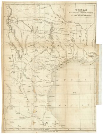
One of the few maps showing the Republic of Texas
£750KENDALL, George Wilkins.
Published In 1844
Stock No. 23325 -

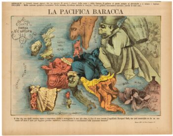
A rare Italian serio-comic map of Europe in 1871
£20,000MANFREDO, Manfredi.
Published In 1871
Stock No. 23283 -

Early map of the roads from Lichfield to Chester
£280OGILBY, John.
Published In 1675
Stock No. 23239 -

An Italian edition of Hadol’s serio-comic map of Europe
£1,200HADOL, Paul.
Published In 1888
Stock No. 23202 -
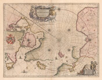
A 17th century map of the early exploration of the Arctic Circle
£1,250BLAEU, Johannes.
Published In 1662
Stock No. 23200 -

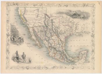
Map of Mexico, with Texas and California as part of the USA
£380TALLIS, John.
Published In 1850
Stock No. 22915 -

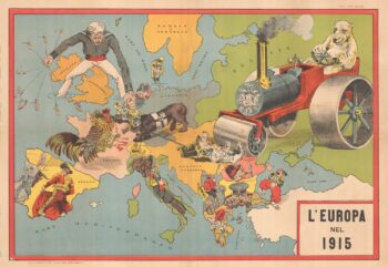
An Italian Serio-Comic map of Europe during the Great War
£2,500Anonymous.
Published In 1915
Stock No. 22636 -

An in-depth survey of mapping in England
£25DELANO-SMITH, Catherine & Kain, Roger J.P.
Published In 1999
Stock No. 22586