Showing 25–36 of 107 results
-

The first published chart of Macquarie Harbour in Tasmania
£1,200DUPERREY, Louis-Isidore.
Published In 1829
Stock No. 23960 -

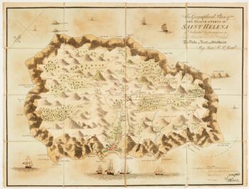
Read’s map of Napoleon’s exile on St Helena, Second State
£1,200READ, R.P.
Published In 1817
Stock No. 22662 -

Napoleon in exile on St Helena
£1,400READ, R.P.
Published In 1815
Stock No. 22661 -

Read’s map of Napoleon’s exile on St Helena, First State
£1,200READ, R.P.
Published In 1815
Stock No. 22660 -

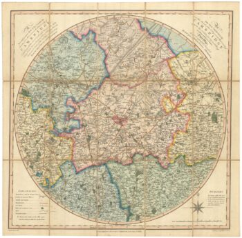
An early 19th century circular map of the environs of Cambridge
£400RICHARDSON, J.
Published In 1828
Stock No. 23649 -

A 16th century Italian plan of Cambridge
£500VALEGIO, Francesco.
Published In 1598
Stock No. 24132 -

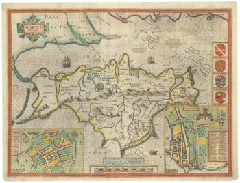
A scarce edition of Speed’s map of the Isle of Wight
£800SPEED, John.
Published In 1665
Stock No. 23823 -

The famous map of Leinster by John Speed
£750SPEED, John.
Published In 1665
Stock No. 23786 -

An 18th century map of New South Wales
£320WILKINSON, Robert.
Published In 1794
Stock No. 23692 -

The first published charts of Botany Bay and the Endeavour River
£400COOK, James.
Published In 1773
Stock No. 23669 -

A miniature map of Mahe
£190WATERLOW & SONS LTD
Published In 1900
Stock No. 23635 -

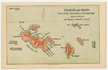
A miniature map of the northern Seychelles islands.
£175WATERLOW & SONS LTD
Published In 1900
Stock No. 23633