Showing 1–12 of 173 results
-

A 16th century woodcut map of Poland, Lithuania and Hungary
£700MUNSTER, Sebastian.
Published In 1572
Stock No. 24574 -

A scarce 18th century map of the Polish-Lithuanian Commonwealth
£950NOLIN, Jean Baptiste jnr.
Published In 1742
Stock No. 24544 -

A 17th century map of Poland
£750DE ROSSI, Giovanni Giacomo.
Published In 1685
Stock No. 24518 -

Four scarce Italian playing cards depicting Poland
£850Anonymous.
Published In 1790
Stock No. 24241 -

16th century Dutch map of Switzerland
£800ORTELIUS, Abraham.
Published In 1575
Stock No. 21809 -

16th century woodblock map of Silesia
£300MUNSTER, Sebastian.
Published In 1572
Stock No. 24582 -

A 16th century woodcut map of Switzerland
£400MUNSTER, Sebastian.
Published In 1572
Stock No. 24570 -

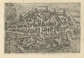
A 16th century town plan of Zurich
£380VALEGIO, Francesco.
Published In 1598
Stock No. 24208 -

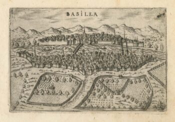
A 16th century town plan of Basle
£280VALEGIO, Francesco.
Published In 1598
Stock No. 24207 -

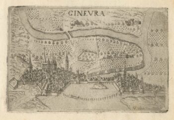
A 16th century town plan of Geneva
£220VALEGIO, Francesco.
Published In 1598
Stock No. 24206 -

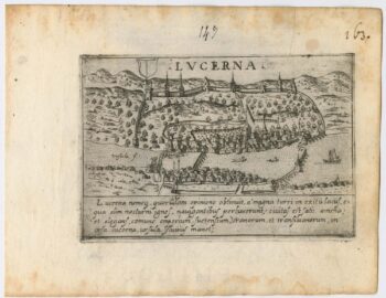
A 16th century town plan of Lucerne
£300VALEGIO, Francesco.
Published In 1598
Stock No. 24205 -

A 16th century town plan of Corfu City
£250VALEGIO, Francesco.
Published In 1598
Stock No. 24181