Showing 1–12 of 51 results
-

A monumental sea chart of south-west England
£3,250HOOGHE, Romeyn de.
Published In 1693
Stock No. 24483 -

A rare 17th century Dutch sea chart of the British Isles
£1,400DONCKER, Hendrik.
Published In 1665
Stock No. 22272 -

The Salvation Army’s vision of a new Utopia
£250BOOTH, William.
Published In 1890
Stock No. 24450 -

An 18th century two-sheet sea chart of the English Channel based on Halley
£1,250MOUNT & PAGE.
Published In 1745
Stock No. 23424 -

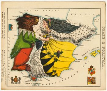
A satirical map of Spain & Portugal
£500ALEPH [HARVEY, William].
Published In 1869
Stock No. 23755 -

A satirical map of Holland & Belgium
£500ALEPH [HARVEY, William].
Published In 1869
Stock No. 23754 -

An allegorical map of map of England
£750ALEPH [HARVEY, William].
Published In 1869
Stock No. 23751 -

A satirical map of Ireland
£650ALEPH [HARVEY, William].
Published In 1869
Stock No. 23750 -
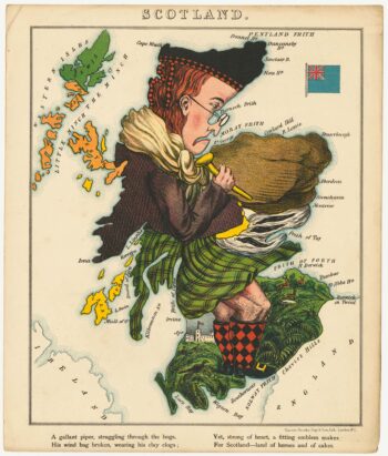
A satirical map of Scotland
£650ALEPH [HARVEY, William].
Published In 1869
Stock No. 23749 -

Caricature map of Italy
£650ALEPH [HARVEY, William].
Published In 1869
Stock No. 23748 -

Pictorial map of Russia
£650ALEPH [HARVEY, William].
Published In 1869
Stock No. 23747 -

An 18th century map of the West Indies
£290JEFFERYS, Thomas.
Published In 1768
Stock No. 23673