- Reset all
- America
- Antarctic
- Atlases
- Azores
- Balearics
- Beijing
- Bolivia
- British Isles Sea Charts
- Buckinghamshire
- Burma
- China
- Cyprus
- Devon
- Florida
- Germany
- Gibraltar
- Globes and Instruments
- Greece
- Gulf States
- India
- Indonesia
- Ionian Islands
- Lancashire
- Latvia and Estonia
- London Localities
- Madagascar
- Map Games
- Marche
- Maritime
- Morocco
- New York
- Panama
- Pennsylvania
- Rutland
- Scottish Islands
- Serio-Comic
- Southern Europe
- Suffolk
- Sussex
- Switzerland
- Tuscany
- Ukraine
- Umbria
- World
Showing 37–48 of 1120 results
-

An early 19th century map of India.
£240POIRSON, J.B.
Published In 1803
Stock No. 24554 -

18th century map of China
£320TIRION, Isaak.
Published In 1740
Stock No. 24547 -

Vancouver’s mapping of the Pacific North West
£350VANCOUVER, Capt. George.
Published In 1820
Stock No. 24534 -

Seven scarce Italian playing cards depicting the Balkans and Greece
£480Anonymous.
Published In 1790
Stock No. 24361 -

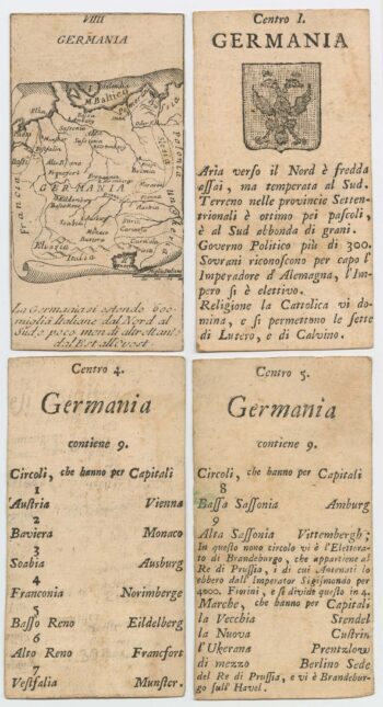
Four scarce Italian playing cards depicting Germany
£280Anonymous.
Published In 1790
Stock No. 24244 -

A 16th century town plan of Tangier
£220VALEGIO, Francesco.
Published In 1598
Stock No. 24217 -

A 16th century town plan of Casablanca
£240VALEGIO, Francesco.
Published In 1598
Stock No. 24215 -

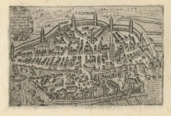
A 16th century town plan of Zurich
£380VALEGIO, Francesco.
Published In 1598
Stock No. 24208 -

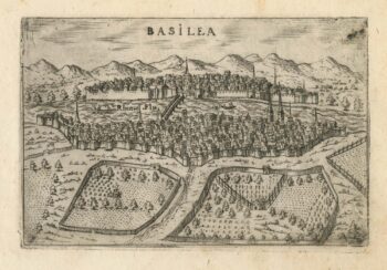
A 16th century town plan of Basle
£280VALEGIO, Francesco.
Published In 1598
Stock No. 24207 -

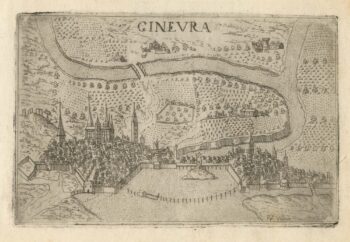
A 16th century town plan of Geneva
£220VALEGIO, Francesco.
Published In 1598
Stock No. 24206 -

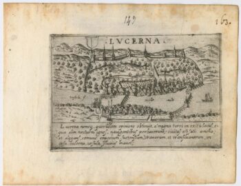
A 16th century town plan of Lucerne
£300VALEGIO, Francesco.
Published In 1598
Stock No. 24205 -

A 16th century town plan of Rhodes
£250ROTA, Martin.
Published In 1598
Stock No. 24199