Showing 649–660 of 738 results
-

The Battle of Burkersdorf during the Seven Years’ War
£250RASPE, Gabriel Nikolaus.
Published In 1762
Stock No. 12939 -

Map of St Lucia during the Seven Years’ War
£160RASPE, Gabriel Nikolaus.
Published In 1762
Stock No. 12920 -

Map of Grenada during the Seven Years’ War
£160RASPE, Gabriel Nikolaus.
Published In 1762
Stock No. 12916 -

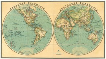
A late-19th century double-hemisphere world map in Cyrillic
£1,900IL'IN, A.
Published In 1890
Stock No. 19431 -

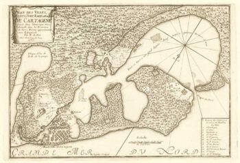
French chart of Cartagena and surrounds
£220FER, Nicolas de.
Published In 1705
Stock No. 18422 -

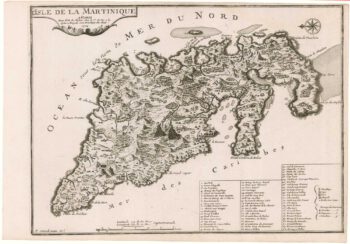
Early 18th century map of Martinique
£250FER, Nicolas de.
Published In 1704
Stock No. 18419 -

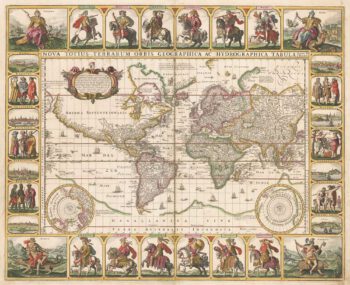
A world map with portraits of the Twelve Caesars
£20,000VISSCHER, Claes Janszoon.
Published In 1652
Stock No. 17720 -

An early English chart of northern Canada with Hudson Bay
£300THORNTON, John.
Published In 1748
Stock No. 15550 -

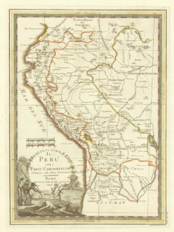
18th century map of Peru & Ecuador
£200CASSINI, Giovanni Maria.
Published In 1798
Stock No. 15543 -

Knightsbridge from an important large-scale survey of London
£600HORWOOD, Richard.
Published In 1794
Stock No. 14121 -

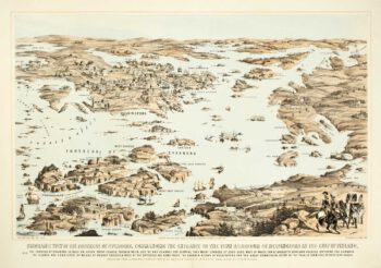
Ariel view of Helsinki and the Fortress of Sveaborg during the Crimean War
£800PACKER, Thomas.
Published In 1855
Stock No. 14080 -

Rare map of Middlesex, Essex and Herts
£1,100WARBURTON, John.
Published In 1726
Stock No. 12907