- Reset all
- America
- Argentina
- Atlases and Books
- Beijing
- Bering Strait
- Bolivia
- Books
- British Isles Sea Charts
- Derbyshire
- Dorset
- French Regions
- Grenada
- Iceland
- India
- Italy Maps
- Latvia and Estonia
- London
- Middlesex
- North Africa
- Northern Europe
- Oxfordshire
- Shropshire
- Spain
- Wales
- West Coast
- West Indies
- Wind Roses
- World
Showing 733–744 of 780 results
-

18th century map of Finland
£400SEUTTER, Matthaus.
Published In 1730
Stock No. 11101 -

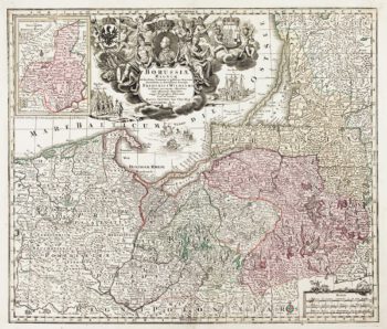
Detailed map of Prussia
£390SEUTTER, Matthaus.
Published In 1730
Stock No. 10985 -

Catalonia
£125BODENEHR, Gabriel.
Published In 1704
Stock No. 10878 -

Miniature map of Guiana
£125DU VAL, Pierre.
Published In 1682
Stock No. 10856 -

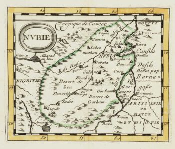
Miniature map of Nubia
£80DU VAL, Pierre.
Published In 1682
Stock No. 10830 -

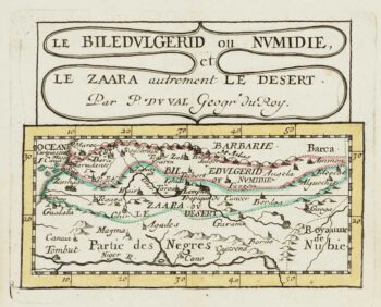
Miniature map of Mauretania & the Sahara
£80DU VAL, Pierre.
Published In 1682
Stock No. 10828 -
Miniature map of Peru
£80DU VAL, Pierre.
Published In 1682
Stock No. 10824 -
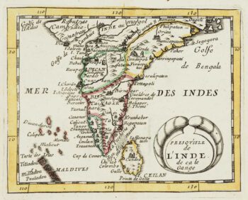
Miniature map of India
£200DU VAL, Pierre.
Published In 1682
Stock No. 10809 -

Abyssinia, with the mythical kingdom of Prester John
£280MONTANUS, Arnoldus.
Published In 1670
Stock No. 10724 -

A large and detailed chart of the Bahamas
£650BELLIN, Jacques-Nicolas.
Published In 1768
Stock No. 10641 -

Cook’s Third Voyage, with the First Map of Hawaii
£3,750COOK, James.
Published In 1785
Stock No. 10583 -

A pictorial map of the Baltic theatre of the Crimean War
£325ILLUSTRATED LONDON NEWS.
Published In 1856
Stock No. 10369