
Showing 1–12 of 627 results
-
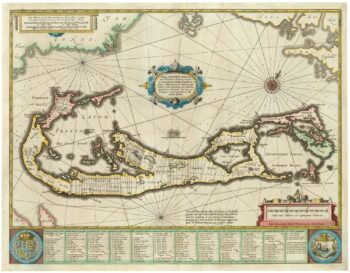
Richard Norwood’s map of Bermuda
£1,000HONDIUS, Henricus.
Published In 1633
Stock No. 24607 -

17th century map of the Sun
£1,850KIRCHER, Athanasius.
Published In 1665
Stock No. 24606 -

18th century map of the Eastern Seaboard
£750ROBERT DE VAUGONDY, Didier.
Published In 1770
Stock No. 24555 -

An 18th century map of North America
£1,200WEIGEL, Christoph.
Published In 1718
Stock No. 24541 -

18th century Italian map of the West Indies
£550CASSINI, Giovanni Maria.
Published In 1798
Stock No. 24532 -

A detailed plan of Kensington Gardens and Hyde Park
£750ORDNANCE SURVEY.
Published In 1906
Stock No. 24529 -

A map illustrating the British dominance of the seas
£450LONDON GEOGRAPHICAL INSTITUTE.
Published In 1922
Stock No. 24508 -

The Peutinger Table, one of the few surviving examples of Roman cartography
£2,000JANSSON, Jan.
Published In 1700
Stock No. 24492 -

Magini’s edition of Ptolemy’s Geography
£6,000MAGINI, Giovanni Antonio.
Published In 1598
Stock No. 24449 -

Ortelius’s map of Barbary in fine colour
£600ORTELIUS, Abraham.
Published In 1603
Stock No. 23807 -

The First Issue of the iconic map of the London Underground, with overprinting
£2,600BECK, Henry C.
Published In 1933
Stock No. 24422 -

A miniature double-hemisphere world.
£600SANSON, Nicolas.
Published In 1735
Stock No. 22316


