- Reset all
- America
- Argentina
- Atlases
- Atlases and Books
- Beijing
- Bering Strait
- Bolivia
- Books
- Burma
- Calabria
- Canada
- Derbyshire
- Dominica
- Dorset
- Eastern Seaboard Maps
- French Regions
- Iceland
- Latvia and Estonia
- London
- Luxembourg
- Martinique
- Mexico
- Middlesex
- North Africa
- Panama
- Scientific Instruments
- Surrey
- Switzerland
- The Guianas
- Tuscany
- Wales
- West Indies
- Wind Roses
- World
Showing 637–641 of 641 results
-

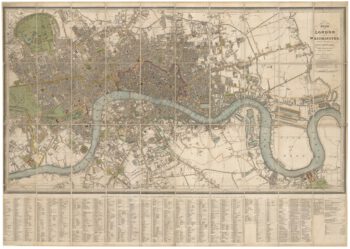
Detailed plan of London under William IV
£3,000FADEN, William.
Published In 1830
Stock No. 22893 -

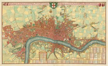
A pirate edition of Morden & Lea’s map of London
£5,000MORDEN, Robert & LEA, Philip.
Published In 1750
Stock No. 22890 -

A scarce world map after Giuseppe Rosaccio
£4,500ROSACCIO, Alovisio.
Published In 1610
Stock No. 22849 -

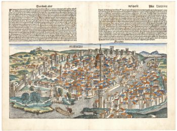
One of the earliest obtainable views of Florence
£1,800SCHEDEL, D. Hartmann.
Published In 1493
Stock No. 22848 -

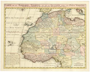
An 18th century map of Northwest Africa
£340CHATELAIN, Henri Abraham.
Published In 1720
Stock No. 22881