- Reset all
- America
- Argentina
- Atlases
- Atlases and Books
- Beijing
- Bering Strait
- Bolivia
- Books
- Burma
- Calabria
- Canada
- Derbyshire
- Dominica
- Dorset
- Eastern Seaboard Maps
- French Regions
- Iceland
- Latvia and Estonia
- London
- Luxembourg
- Martinique
- Mexico
- Middlesex
- North Africa
- Panama
- Scientific Instruments
- Surrey
- Switzerland
- The Guianas
- Tuscany
- Wales
- World
Showing 625–636 of 637 results
-

Blue-Back Chart of the Bay of Biscay
£650STEEL & CO.
Published In 1813
Stock No. 9661 -

The search for the North West Passage
£700MORTIER, Pierre.
Published In 1705
Stock No. 8709 -

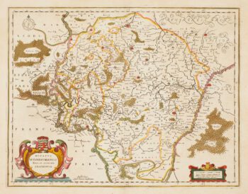
Guyenne
£240JANSSON, Jan.
Published In 1666
Stock No. 8391 -

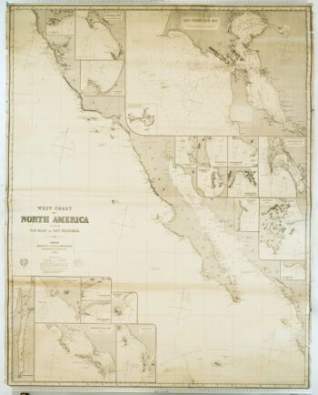
Blue-back chart of the West Coast of the USA
£950IMRAY, James.
Published In 1870
Stock No. 8360 -

17th century map of Luxembourg in fine colour
£380JANSSON, Jan.
Published In 1666
Stock No. 8217 -
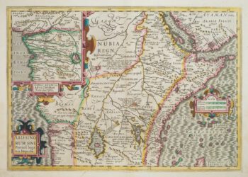
The mythical kingdom of Prester John in Abyssinia
£350HONDIUS, Jodocus.
Published In 1613
Stock No. 7946 -

Rare map of the Bering Strait
£350CASSINI, Giovanni Maria.
Published In 1798
Stock No. 7375 -

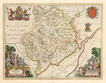
Blaeu’s map of Monmouthshire, with fine colour
£500BLAEU, Johannes.
Published In 1662
Stock No. 23039 -

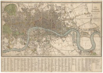
Detailed plan of London under William IV
£3,000FADEN, William.
Published In 1830
Stock No. 22893 -

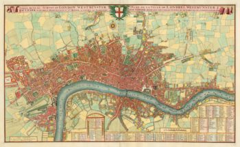
A pirate edition of Morden & Lea’s map of London
£5,000MORDEN, Robert & LEA, Philip.
Published In 1750
Stock No. 22890 -

A scarce world map after Giuseppe Rosaccio
£4,500ROSACCIO, Alovisio.
Published In 1610
Stock No. 22849 -

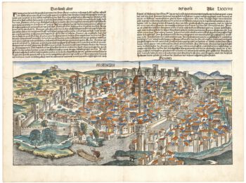
One of the earliest obtainable views of Florence
£1,800SCHEDEL, D. Hartmann.
Published In 1493
Stock No. 22848