- Reset all
- America
- Atlases and Books
- Beijing
- Bering Strait
- Bolivia
- Books
- Calabria
- Canada
- Derbyshire
- Dominica
- Dorset
- Essex
- French Regions
- Iceland
- Korea
- Latvia and Estonia
- London
- Luxembourg
- Martinique
- Mexico
- Middlesex
- North Africa
- Panama
- Surrey
- Switzerland
- The Guianas
- Wales
- West Indies
- Wind Roses
- World
Showing 589–600 of 617 results
-

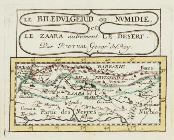
Miniature map of Mauretania & the Sahara
£80DU VAL, Pierre.
Published In 1682
Stock No. 10828 -

Miniature map of Peru
£80DU VAL, Pierre.
Published In 1682
Stock No. 10824 -

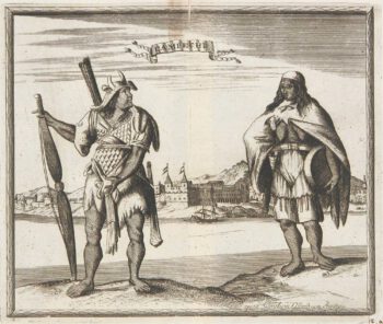
Abyssinia, with the mythical kingdom of Prester John
£280MONTANUS, Arnoldus.
Published In 1670
Stock No. 10724 -

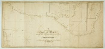
A large and detailed chart of the Bahamas
£650BELLIN, Jacques-Nicolas.
Published In 1768
Stock No. 10641 -

Cook’s Third Voyage, with the First Map of Hawaii
£3,750COOK, James.
Published In 1785
Stock No. 10583 -

A detailed American ‘blue-back’ sea chart of the Brazilian coastline
£1,200BLUNT, E. & G.W.
Published In 1840
Stock No. 10336 -

Virginia & Florida
£1,350BLAEU, Willem Janszoon.
Published In 1647
Stock No. 10145 -

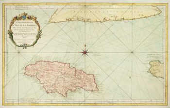
A large chart of Jamaica
£425BELLIN, Jacques-Nicolas.
Published In 1753
Stock No. 10124 -

Campeche
£50ALLARD, Carel.
Published In 1720
Stock No. 9995 -

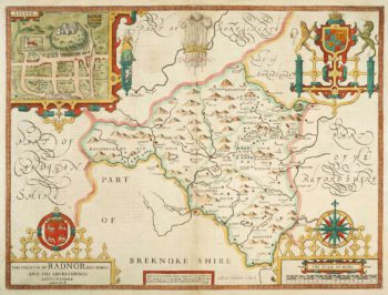
Speed’s county map of Radnor
£280SPEED, John.
Published In 1676
Stock No. 9874 -

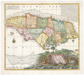
A decorative 18th century map of Jamaica
£475SEUTTER, Matthaus.
Published In 1770
Stock No. 9614 -

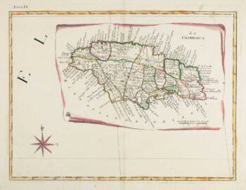
18th century Italian map of Jamaica
£380ZATTA, Antonio.
Published In 1784
Stock No. 9445