- Reset all
- Andalusia
- Antarctic
- Antigua
- Apulia
- Benelux
- Bohemia
- Caspian Sea
- Central America
- China
- Europe
- Falklands
- Hertfordshire
- Holy Land
- Indian Ocean
- Latvia and Estonia
- Liguria
- Luxembourg
- Monaco
- New York
- North Africa
- Northern Italy
- Sardinia
- Scandinavia
- Scientific Instruments
- Scottish Islands
- Singapore
- Texas
- Trentino
- West Indies
- Western Europe
Showing 1057–1068 of 1170 results
-

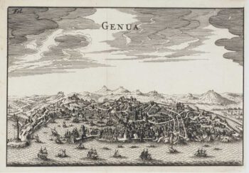
Miniature 17th century bird’s-eye view of Genoa
£250FURTTENBACH, Joseph.
Published In 1627
Stock No. 12590 -

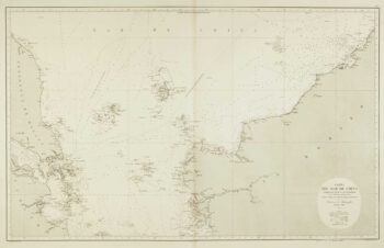
Sea chart of the South China Sea
£750DE LORENZO, J.
Published In 1864
Stock No. 12457 -

Rare 19th centiury Spanish sea chart of China with Taiwan
£1,400FERREIRO, Martin
Published In 1863
Stock No. 12454 -

Sea chart of the East China Sea
£900BRYANT, Tomas.
Published In 1864
Stock No. 12452 -

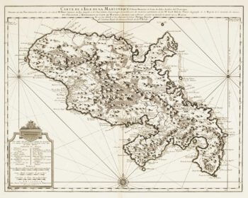
Map of 18th-century Martinique
£550JEFFERYS, Thomas.
Published In 1779
Stock No. 12317 -

18th century map of Martinique
£650COVENS & MORTIER.
Published In 1740
Stock No. 12311 -

Important French map of China by D’Anville
£900ANVILLE, Jean Baptiste B. D'.
Published In 1737
Stock No. 12227 -

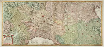
A two-sheet old map of the Po River
£1,300CERRUTI, Agostino.
Published In 1735
Stock No. 12221 -

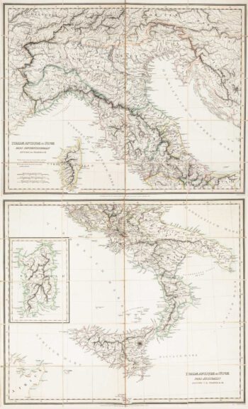
Two-sheet folding map of Italy
£650CRAMER. John Anthony.
Published In 1825
Stock No. 12143 -

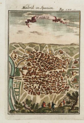
A 17th century prospect of Madrid
£150MALLET, Alain Manesson.
Published In 1684
Stock No. 12100 -

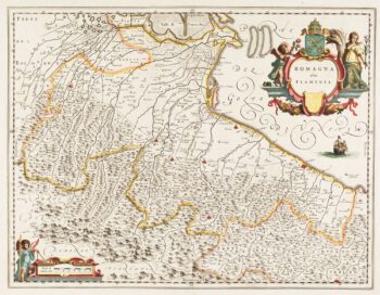
Classic 17th century Blaeu map of Romagna
£300BLAEU, Johannes.
Published In 1640
Stock No. 12069 -
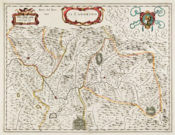
17th century map of Cadore
£200BLAEU, Johannes.
Published In 1640
Stock No. 12068