Showing 1–12 of 318 results
-

Blaeu’s classic 17th century map of Iceland
£1,200BLAEU, Willem Janszoon.
Published In 1635
Stock No. 24604 -

16th century woodcut map of Sri Lanka as Taprobana
£500MUNSTER, Sebastian.
Published In 1574
Stock No. 24578 -

An early woodcut map of Scandinavia
£1,100MUNSTER, Sebastian.
Published In 1572
Stock No. 24567 -

An 18th century map of North America
£1,200WEIGEL, Christoph.
Published In 1718
Stock No. 24541 -

Four scarce Italian playing cards depicting Norway
£850Anonymous.
Published In 1790
Stock No. 24246 -

A mid-18th century map of North America
£850LOTTER, Tobias Conrad.
Published In 1765
Stock No. 24610 -

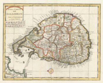
18th century map of Sri Lanka
£260TIRION, Isaak.
Published In 1740
Stock No. 24548 -

The uncommon Spanish edition of Blaeu’s map of Hertfordshire
£450BLAEU, Johannes.
Published In 1662
Stock No. 24521 -

John Oxley’s mapping of New South Wales
£280HALL, Sidney.
Published In 1828
Stock No. 24519 -

A 16th century town plan of Bruges
£240VALEGIO, Francesco.
Published In 1598
Stock No. 24204 -
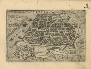
A 16th century town plan of Antwerp
£250VALEGIO, Francesco.
Published In 1598
Stock No. 24203 -

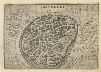
A 16th century town plan of Brussels
£250VALEGIO, Francesco.
Published In 1598
Stock No. 24202