Showing 1–12 of 708 results
-

16th century woodcut map of Sri Lanka as Taprobana
£500MUNSTER, Sebastian.
Published In 1574
Stock No. 24578 -

An early woodcut map of England
£1,000MUNSTER, Sebastian.
Published In 1572
Stock No. 24564 -

A late Victorian plan of Brighton.
£1,100TREACHER, H. & C.
Published In 1890
Stock No. 24546 -

A rare 18th century townplan of Worcester
£2,400YOUNG, George.
Published In 1780
Stock No. 24545 -

A large and detailed 19th century map of India
£750WALKER, John.
Published In 1829
Stock No. 24543 -

A detailed plan of Kensington Gardens and Hyde Park
£750ORDNANCE SURVEY.
Published In 1906
Stock No. 24529 -

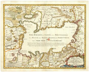
An 18th century map of the Caspian Sea
£700DE ROSSI, Domenico.
Published In 1723
Stock No. 24517 -

The First Issue of the iconic map of the London Underground, with overprinting
£2,600BECK, Henry C.
Published In 1933
Stock No. 24422 -

A 17th century map of of the Mogol Empire
£700CANTELLI DA VIGNOLA, Giacomo.
Published In 1683
Stock No. 24609 -

Nash’s planned layout of Regent Street
£980LUFFMAN, John.
Published In 1814
Stock No. 18274 -

John Nash’s remodelling of St James’s Park
£950MOGG, Edward.
Published In 1827
Stock No. 18193 -

A late-Georgian map of the environs of London
£650CRUCHLEY, George Frederick.
Published In 1827
Stock No. 15495