Showing 1–12 of 642 results
-

An early woodcut map of England
£1,000MUNSTER, Sebastian.
Published In 1572
Stock No. 24564 -

A late Victorian plan of Brighton.
£1,100TREACHER, H. & C.
Published In 1890
Stock No. 24546 -

A rare 18th century townplan of Worcester
£2,400YOUNG, George.
Published In 1780
Stock No. 24545 -

A detailed plan of Kensington Gardens and Hyde Park
£750ORDNANCE SURVEY.
Published In 1906
Stock No. 24529 -

The First Issue of the iconic map of the London Underground, with overprinting
£2,600BECK, Henry C.
Published In 1933
Stock No. 24422 -

Nash’s planned layout of Regent Street
£980LUFFMAN, John.
Published In 1814
Stock No. 18274 -

John Nash’s remodelling of St James’s Park
£950MOGG, Edward.
Published In 1827
Stock No. 18193 -

A late-Georgian map of the environs of London
£650CRUCHLEY, George Frederick.
Published In 1827
Stock No. 15495 -

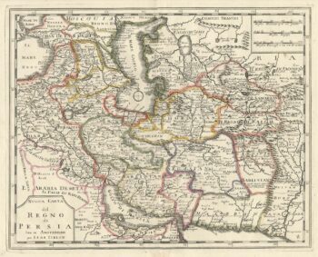
An 18th century Italian map of Persia
£300TIRION, Isaak.
Published In 1740
Stock No. 24550 -

The uncommon Spanish edition of Blaeu’s map of Hertfordshire
£450BLAEU, Johannes.
Published In 1662
Stock No. 24521 -

A Victorian map of London illustating the famous buildings
£350SMITH, Charles & Son.
Published In 1871
Stock No. 24520 -

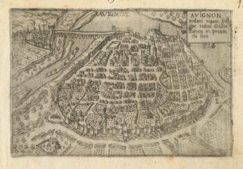
A 16th century town plan of Avignon
£150VALEGIO, Francesco.
Published In 1598
Stock No. 24211