Showing 1–12 of 313 results
-

Blaeu’s classic 17th century map of Iceland
£1,200BLAEU, Willem Janszoon.
Published In 1635
Stock No. 24604 -

An early woodcut map of Scandinavia
£1,100MUNSTER, Sebastian.
Published In 1572
Stock No. 24567 -

A map illustrating the British dominance of the seas
£450LONDON GEOGRAPHICAL INSTITUTE.
Published In 1922
Stock No. 24508 -

Four scarce Italian playing cards depicting Norway
£850Anonymous.
Published In 1790
Stock No. 24246 -

A miniature double-hemisphere world.
£600SANSON, Nicolas.
Published In 1735
Stock No. 22316 -

The uncommon Spanish edition of Blaeu’s map of Hertfordshire
£450BLAEU, Johannes.
Published In 1662
Stock No. 24521 -

A 16th century town plan of Bruges
£240VALEGIO, Francesco.
Published In 1598
Stock No. 24204 -

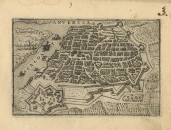
A 16th century town plan of Antwerp
£250VALEGIO, Francesco.
Published In 1598
Stock No. 24203 -

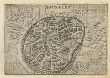
A 16th century town plan of Brussels
£250VALEGIO, Francesco.
Published In 1598
Stock No. 24202 -

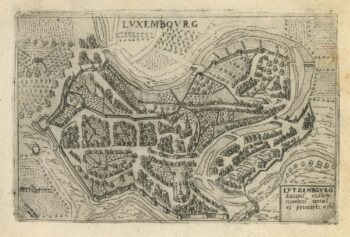
A 16th century town plan of Luxembourg
£300VALEGIO, Francesco.
Published In 1598
Stock No. 24201 -

A 16th century town plan of Helsingor
£160VALEGIO, Francesco.
Published In 1598
Stock No. 24200 -

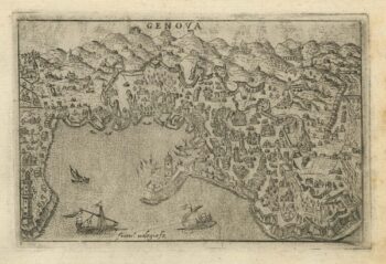
A 16th century town plan of Genova
£250VALEGIO, Francesco.
Published In 1598
Stock No. 24198