- Reset all
- Antarctic
- Argentina
- Atlases
- Azores
- Balearics
- Bolivia
- Books about Maps
- British Isles Sea Charts
- Buckinghamshire
- Burma
- China
- Cyprus
- Devon
- Florida
- Germany
- Gibraltar
- Greece
- Gulf States
- Iceland
- Indian Ocean
- Indonesia
- Ionian Islands
- Lancashire
- Latvia and Estonia
- London Localities
- London Transport Maps
- Madagascar
- Map Games
- Maritime
- Morocco
- Panama
- Pennsylvania
- Rutland
- Scottish Islands
- Serio-Comic
- Sicily
- Southern Europe
- Suffolk
- Sussex
- Switzerland
- Tuscany
- Ukraine
- Umbria
- World
Showing 1–12 of 914 results
-

Blaeu’s classic 17th century map of Iceland
£1,200BLAEU, Willem Janszoon.
Published In 1635
Stock No. 24604 -

16th century woodblock prospect of Lisbon
£450MUNSTER, Sebastian.
Published In 1580
Stock No. 24586 -

Munster’s classic woodcut map of Italy
£850MUNSTER, Sebastian.
Published In 1572
Stock No. 24562 -

The English edition of Du Halde’s map of Guangdong
£1,600DU HALDE, Johann Baptiste.
Published In 1738
Stock No. 24558 -

A classic 16th century Dutch map of Italy
£1,400ORTELIUS, Abraham.
Published In 1572
Stock No. 24552 -

A late Victorian plan of Brighton.
£1,100TREACHER, H. & C.
Published In 1890
Stock No. 24546 -

A detailed plan of Kensington Gardens and Hyde Park
£750ORDNANCE SURVEY.
Published In 1906
Stock No. 24529 -

A map illustrating the British dominance of the seas
£450LONDON GEOGRAPHICAL INSTITUTE.
Published In 1922
Stock No. 24508 -

The Peutinger Table, one of the few surviving examples of Roman cartography
£2,000JANSSON, Jan.
Published In 1700
Stock No. 24492 -

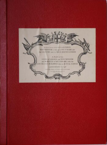
Facsimile of both Rocque’s 24 & 16-sheet map of London
£650ROCQUE, John.
Published In 1971
Stock No. 24478 -

Magini’s edition of Ptolemy’s Geography
£6,000MAGINI, Giovanni Antonio.
Published In 1598
Stock No. 24449 -

16th century map of the Kingdom of Naples
£650ORTELIUS, Abraham.
Published In 1595
Stock No. 24444