- Reset all
- Antigua
- Argentina
- Bering Strait
- Bolivia
- British Isles
- Canada
- Canary Islands
- Cumberland
- Devon
- Eastern Europe
- Eastern Seaboard Maps
- Ecuador
- Egypt
- Elba
- Georgia
- Gulf States
- Hertfordshire
- Lancashire
- Latvia and Estonia
- London Environs
- Madeira
- Maritime
- Morocco
- Near East
- Netherlands
- North America Maps
- Northamptonshire
- Nottinghamshire
- Prints
- Russia
- Scottish Islands
- Solar System
- St Lucia
- Switzerland
- Trentino
- United States
- Vietnam
- Virginia
- Westmorland
- World and Continents
- World Maps
Showing 13–24 of 871 results
-

16th century Dutch map of Switzerland
£800ORTELIUS, Abraham.
Published In 1575
Stock No. 21809 -

A late-Georgian map of the environs of London
£650CRUCHLEY, George Frederick.
Published In 1827
Stock No. 15495 -

A 16th century woodcut map of Switzerland
£400MUNSTER, Sebastian.
Published In 1572
Stock No. 24570 -

The building of the Uptown Hudson Tubes in New York
£450Anonymous.
Published In 1890
Stock No. 24556 -

An early 18th century map of the Middle East
£450CHATELAIN, Henri Abraham.
Published In 1720
Stock No. 24551 -

Vancouver’s mapping of the Pacific North West
£350VANCOUVER, Capt. George.
Published In 1820
Stock No. 24534 -

A scarce map of the Holy Land in the 18th century
£250FER, Nicolas de.
Published In 1707
Stock No. 24525 -

A scarce map of the Holy Land in Biblical times
£250FER, Nicolas de.
Published In 1707
Stock No. 24524 -

The uncommon Spanish edition of Blaeu’s map of Hertfordshire
£450BLAEU, Johannes.
Published In 1662
Stock No. 24521 -

Seven scarce Italian playing cards depicting Russia
£480Anonymous.
Published In 1790
Stock No. 24360 -

A 16th century town plan of Tangier
£220VALEGIO, Francesco.
Published In 1598
Stock No. 24217 -

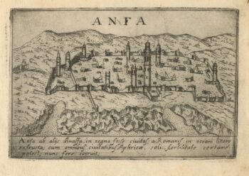
A 16th century town plan of Casablanca
£240VALEGIO, Francesco.
Published In 1598
Stock No. 24215