- Reset all
- Antigua
- Asia Continent
- Black Sea
- Books about Maps
- Calabria
- Campania
- China
- Europe
- Hispaniola
- Hungary
- Iceland
- Italy
- Jamaica
- Maritime
- Monaco
- Near East
- North America
- Pacific and Australasia
- Provence
- Rutland
- Scientific Instruments
- Shropshire
- Somerset
- Southern Italy
- St Kitts
- Tartary
- West Indies Maps
- Worcestershire
- Zodiac
Showing 1225–1236 of 1296 results
-

18th century map of Finland
£400SEUTTER, Matthaus.
Published In 1730
Stock No. 11101 -

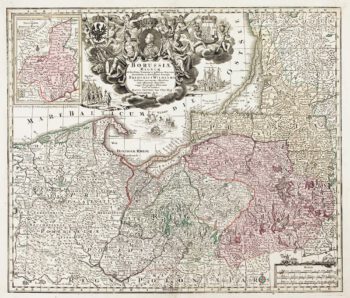
Detailed map of Prussia
£390SEUTTER, Matthaus.
Published In 1730
Stock No. 10985 -

A manuscript design for the new pier at Genoa
£500Anonymous.
Published In 1715
Stock No. 10882 -

Catalonia
£125BODENEHR, Gabriel.
Published In 1704
Stock No. 10878 -

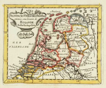
Miniature map of Holland
£140DU VAL, Pierre.
Published In 1682
Stock No. 10859 -

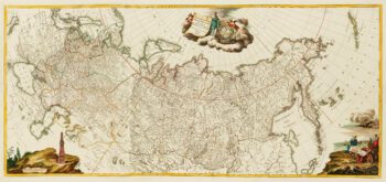
An impressive three-sheet map of the Russian Empire
£2,950TRESCOTT, John & SCHMIDT, Jakob.
Published In 1782
Stock No. 10643 -

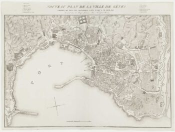
A fine town-plan of Genoa
£450ZUCOLI, Léon.
Published In 1849
Stock No. 10532 -

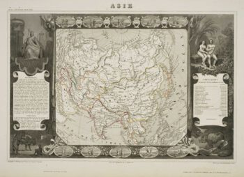
Decorative 19th century map of Asia
£170LEVASSEUR, Victor.
Published In 1850
Stock No. 10460 -

A pictorial map of the Baltic theatre of the Crimean War
£325ILLUSTRATED LONDON NEWS.
Published In 1856
Stock No. 10369 -

The Maritime Alps
£450CORONELLI, Vincenzo Maria.
Published In 1690
Stock No. 10278 -

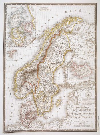
Detailed 19th century map of Scandinavia
£160BRUÉ, Adrien Hubert.
Published In 1825
Stock No. 10277 -

Blaeu’s famous plan of Frankfurt in original colours
£950BLAEU, Johannes.
Published In 1640
Stock No. 10159