Showing 1–12 of 348 results
-

An early woodcut map of England
£1,000MUNSTER, Sebastian.
Published In 1572
Stock No. 24564 -

A late Victorian plan of Brighton.
£1,100TREACHER, H. & C.
Published In 1890
Stock No. 24546 -

A rare 18th century townplan of Worcester
£2,400YOUNG, George.
Published In 1780
Stock No. 24545 -

The uncommon Spanish edition of Blaeu’s map of Hertfordshire
£450BLAEU, Johannes.
Published In 1662
Stock No. 24521 -

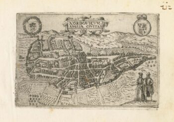
A 16th century town plan of Norwich
£300VALEGIO, Francesco.
Published In 1598
Stock No. 24135 -

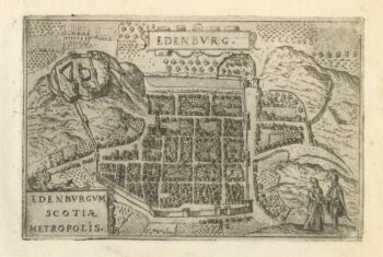
A 16th century town plan of Edinburgh
£380VALEGIO, Francesco.
Published In 1598
Stock No. 24133 -

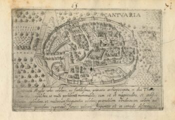
A 16th century Italian plan of Canterbury
£280VALEGIO, Francesco.
Published In 1598
Stock No. 24131 -

A scarce map of Scotland
£1,000BROWNE, Christopher.
Published In 1721
Stock No. 24436 -

Vrients’s scarce map of England, Wales & Ireland
£4,250VRIENTS, Jan Baptist.
Published In 1612
Stock No. 20271 -

A monumental sea chart of south-west England
£3,250HOOGHE, Romeyn de.
Published In 1693
Stock No. 24483 -
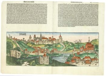
An incunable prospect of Prague
£1,450SCHEDEL, D. Hartmann.
Published In 1493
Stock No. 24451 -

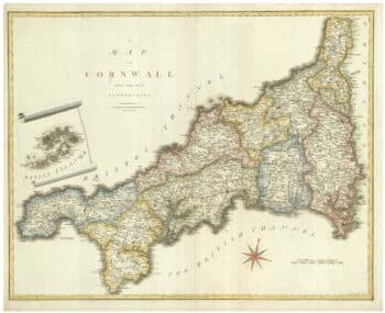
An early 19th century map of Cornwall
£225CARY, John.
Published In 1805
Stock No. 24114