Showing 1–12 of 76 results
-

A 16th century woodcut map of Poland, Lithuania and Hungary
£700MUNSTER, Sebastian.
Published In 1572
Stock No. 24574 -

A scarce 18th century map of the Polish-Lithuanian Commonwealth
£950NOLIN, Jean Baptiste jnr.
Published In 1742
Stock No. 24544 -

A 17th century map of Poland
£750DE ROSSI, Giovanni Giacomo.
Published In 1685
Stock No. 24518 -

Four scarce Italian playing cards depicting Poland
£850Anonymous.
Published In 1790
Stock No. 24241 -

16th century woodblock map of Silesia
£300MUNSTER, Sebastian.
Published In 1572
Stock No. 24582 -
An early 18th century map of the Middle East
£450CHATELAIN, Henri Abraham.
Published In 1720
Stock No. 24551 -

A 16th century town plan of Toledo
£250VALEGIO, Francesco.
Published In 1598
Stock No. 24189 -

A 16th century town plan of Santander
£260VALEGIO, Francesco.
Published In 1598
Stock No. 24188 -

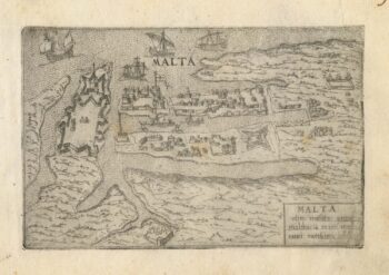
A 16th century town plan of Valletta
£200VALEGIO, Francesco.
Published In 1598
Stock No. 24173 -

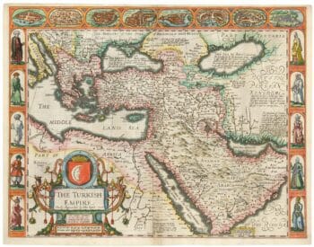
The first English atlas map of the Turkish Empire
£2,500SPEED, John.
Published In 1665
Stock No. 23981 -

A scarce issue of John Speed’s map of Northamptonshire
£650SPEED, John.
Published In 1665
Stock No. 24022 -

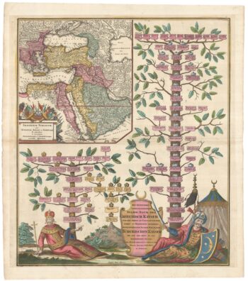
The Genealogies of the Palaiologan Emperors and Ottoman Sultans
£950ROGG, Gottfried.
Published In 1755
Stock No. 23856