Showing 1–12 of 184 results
-

17th century map of the Sun
£1,850KIRCHER, Athanasius.
Published In 1665
Stock No. 24606 -

16th century woodcut map of Sri Lanka as Taprobana
£500MUNSTER, Sebastian.
Published In 1574
Stock No. 24578 -

Magini’s edition of Ptolemy’s Geography
£6,000MAGINI, Giovanni Antonio.
Published In 1598
Stock No. 24449 -

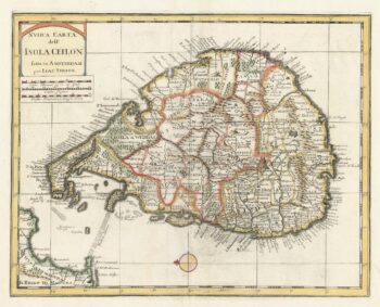
18th century map of Sri Lanka
£260TIRION, Isaak.
Published In 1740
Stock No. 24548 -

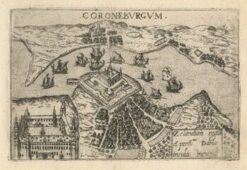
A 16th century town plan of Helsingor
£160VALEGIO, Francesco.
Published In 1598
Stock No. 24200 -

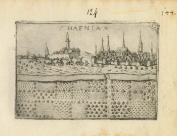
A 16th century town plan of Copenhagen
£290VALEGIO, Francesco.
Published In 1598
Stock No. 24179 -

A 16th century Italian plan of Aden
£240VALEGIO, Francesco.
Published In 1598
Stock No. 24139 -

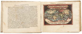
Ortelius’s pocket atlas with the Galle maps in fine colour
£14,000ORTELIUS, Abraham.
Published In 1595
Stock No. 24476 -

A Dutch satirical board game of the Second Boer War
£450SCHLETTE, E.G.
Published In 1900
Stock No. 24484 -

A rare two volume geographical lexicon
£17,500LASOR A VAREA, Alphonsus.
Published In 1713
Stock No. 24516 -
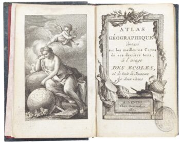
A very fine early 19th century miniature atlas
£2,250REMONDINI, Giuseppe Antonio.
Published In 1801
Stock No. 24527 -

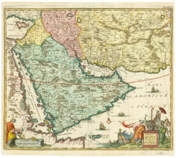
17th century map of Arabia
£1,000MEURS, Jacob van.
Published In 1680
Stock No. 20175