Showing 1–12 of 109 results
-

A 16th century woodcut map of Poland, Lithuania and Hungary
£700MUNSTER, Sebastian.
Published In 1572
Stock No. 24574 -

A late Victorian plan of Brighton.
£1,100TREACHER, H. & C.
Published In 1890
Stock No. 24546 -

A scarce 18th century map of the Polish-Lithuanian Commonwealth
£950NOLIN, Jean Baptiste jnr.
Published In 1742
Stock No. 24544 -

A 17th century map of Poland
£750DE ROSSI, Giovanni Giacomo.
Published In 1685
Stock No. 24518 -

Four scarce Italian playing cards depicting Poland
£850Anonymous.
Published In 1790
Stock No. 24241 -

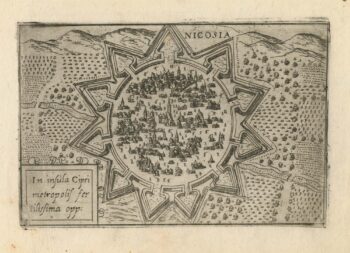
A 16th century town plan of Nicosia
£750VALEGIO, Francesco.
Published In 1598
Stock No. 24176 -

A rare 16th century Italian plan of Famagusta
£950VALEGIO, Francesco.
Published In 1598
Stock No. 24148 -

16th century woodblock map of Silesia
£300MUNSTER, Sebastian.
Published In 1572
Stock No. 24582 -

A 16th century Italian plan of Aden
£240VALEGIO, Francesco.
Published In 1598
Stock No. 24139 -
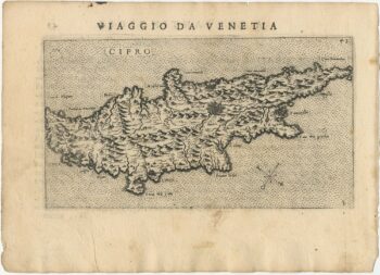
Uncommon 16th century Italian map of Cyprus
£1,600ROSACCIO, Giuseppe.
Published In 1598
Stock No. 24538 -

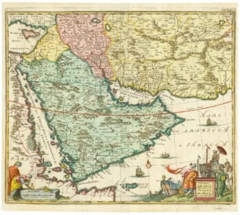
17th century map of Arabia
£1,000MEURS, Jacob van.
Published In 1680
Stock No. 20175 -

Miniature map of Cyprus and the islands of the Aegean
£350HONDIUS, Jodocus II.
Published In 1610
Stock No. 24510