Showing 1–12 of 128 results
-

The Peutinger Table, one of the few surviving examples of Roman cartography
£2,000JANSSON, Jan.
Published In 1700
Stock No. 24492 -

A scarce 17th century prospect of Villefranche-sur-Mer
£1,500BLAEU, Johannes.
Published In 1682
Stock No. 24159 -

16th century woodblock map of France
£380MUNSTER, Sebastian.
Published In 1572
Stock No. 24580 -

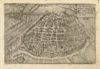
A 16th century town plan of Avignon
£150VALEGIO, Francesco.
Published In 1598
Stock No. 24211 -
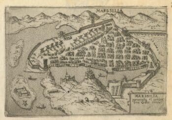
A 16th century town plan of Marseilles
£200VALEGIO, Francesco.
Published In 1598
Stock No. 24210 -

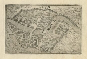
A 16th century town plan of Lyon
£150VALEGIO, Francesco.
Published In 1598
Stock No. 24209 -

A 16th century Italian plan of Aden
£240VALEGIO, Francesco.
Published In 1598
Stock No. 24139 -

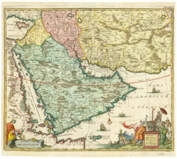
17th century map of Arabia
£1,000MEURS, Jacob van.
Published In 1680
Stock No. 20175 -

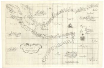
A 17th century sea chart of the Gulf of Aden in Dudley’s unique style
£3,250DUDLEY, Robert.
Published In 1646
Stock No. 23592 -

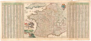
A 17th century map of France with rare gazzetteer side-panels
£750VISSCHER, Nicolas.
Published In 1690
Stock No. 23744 -

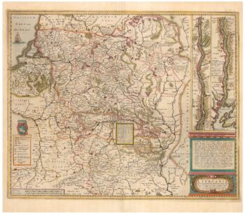
An early example of this 17th century map of Lithuania
£1,200HONDIUS, Henricus.
Published In 1640
Stock No. 24390 -

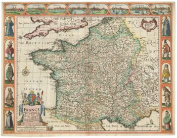
A 17th century English panelled map of France
£1,000SPEED, John.
Published In 1665
Stock No. 23995