Showing 1–12 of 15 results
-

A 16th century town plan of Heraklion
£150VALEGIO, Francesco.
Published In 1598
Stock No. 24180 -

One of the most detailed maps of the Gal?pagos before Darwin
£700VANDERMAELEN, Philippe.
Published In 1827
Stock No. 23920 -

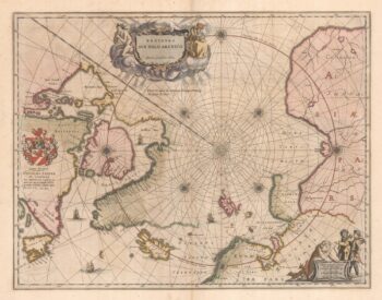
A 17th century map of the early exploration of the Arctic Circle
£1,250BLAEU, Johannes.
Published In 1662
Stock No. 23200 -

A 16th century map of Crete
£180PORCACCHI, Tomaso.
Published In 1590
Stock No. 23214 -

Martin Frobisher’s voyage in search of the North West Passage
£650AA, Pieter van der.
Published In 1714
Stock No. 22079 -

A 17th century Dutch sea chart of the North Atlantic
£1,350GOOS, Pieter.
Published In 1670
Stock No. 21871 -

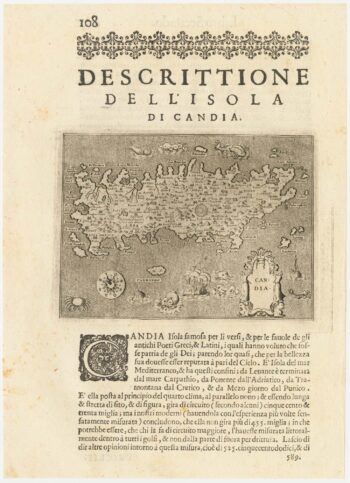
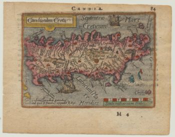
A 16th century miniature map of Crete
£240LANGENES, Barent.
Published In 1599
Stock No. 21328 -

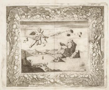
A rare view of Souda, with decorative borders
£460LOCATELLI, Alessandro.
Published In 1691
Stock No. 21035 -

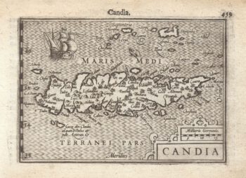
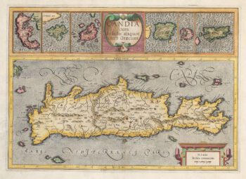
A 16th century miniature map of Crete
£150ORTELIUS, Abraham.
Published In 1593
Stock No. 21003 -

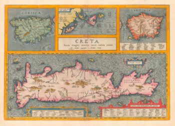
Classical Crete, with Corsica, Sardinia and the Ionian Islands
£625ORTELIUS, Abraham.
Published In 1595
Stock No. 20412 -

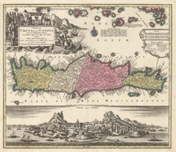
18th century map of Crete with a prospect of Heraklion
£1,000SEUTTER, Matthaus.
Published In 1735
Stock No. 20409 -

Mercator’s maps of the Greek Islands
£500MERCATOR, Gerard.
Published In 1595
Stock No. 20835