Showing 1–12 of 20 results
-

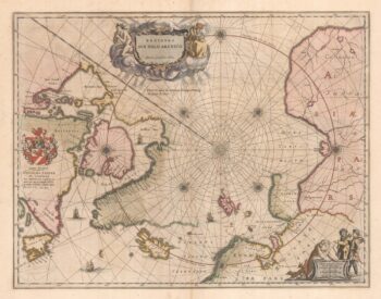
A 17th century map of the early exploration of the Arctic Circle
£1,250BLAEU, Johannes.
Published In 1662
Stock No. 23200 -

Martin Frobisher’s voyage in search of the North West Passage
£650AA, Pieter van der.
Published In 1714
Stock No. 22079 -

A 17th century Dutch sea chart of the North Atlantic
£1,350GOOS, Pieter.
Published In 1670
Stock No. 21871 -

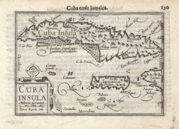
A 16th century miniature map of Cuba
£280LANGENES, Barent.
Published In 1599
Stock No. 21259 -

Cuba, during the Seven Years’ War
£350RASPE, Gabriel Nikolaus.
Published In 1763
Stock No. 20680 -
Cuba from an account of the voyages of Columbus
£350AA, Pieter van der.
Published In 1707
Stock No. 20645 -

A map of Cuba during the Seven Years’ War
£1,100JEFFERYS, Thomas.
Published In 1762
Stock No. 19272 -

An early bird’s-eye view of Havana
£3,250BACHMANN, John.
Published In 1851
Stock No. 19264 -

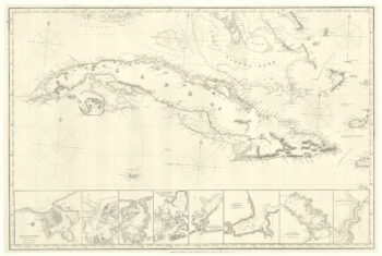
A 19th century blue-back sea chart of Cuba
£2,000IMRAY, James.
Published In 1873
Stock No. 19010 -

A scarce plan of the harbour of Havana
£450CHASSEREAU, Pierre.
Published In 1740
Stock No. 18320 -

View of Havana harbour
£150VERNET, Joseph.
Published In 1780
Stock No. 17575 -

18th century sea chart of Cuba
£1,400BELLIN, Jacques-Nicolas.
Published In 1762
Stock No. 17427