Showing 13–24 of 865 results
-

A late-18th century plan of Berlin
£260ANDREWS, John.
Published In 1800
Stock No. 24513 -

A late-18th century plan of Vienna
£230ANDREWS, John.
Published In 1800
Stock No. 24512 -

Miniature map of Cyprus and the islands of the Aegean
£350HONDIUS, Jodocus II.
Published In 1610
Stock No. 24510 -

An early 17th century map of Iceland
£350HONDIUS, Jodocus.
Published In 1610
Stock No. 24509 -

The founding of St Petersburg by Peter the Great
£700ZATTA, Antonio.
Published In 1797
Stock No. 24504 -

A map of the Russo-Turkish War of 1877-8
£250ILLUSTRATED LONDON NEWS.
Published In 1877
Stock No. 24378 -

First issue of Rumold Mercator’s map of Europe
£2,500MERCATOR, Rumold.
Published In 1595
Stock No. 24298 -

One of the largest printed prospects of Rome
£15,000VASI, Giuseppe.
Published In 1765
Stock No. 24364 -

The famous 17th century map of Italy by John Speed
£2,500SPEED, John.
Published In 1665
Stock No. 23988 -

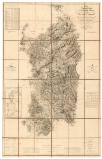
An important 19th century map of Sardinia
£1,100Alberto., Alberto., FERRERO DELLA MARMORA
Published In 1845
Stock No. 24225 -

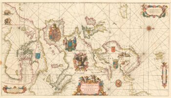
An exceptional 17th century sea chart of Europe on two sheets
£7,500DE WIT, Frederick.
Published In 1675
Stock No. 23450 -

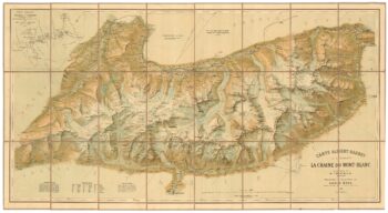
A detailed plan of the Mont-Blanc massif
£1,600BARBEY, Albert.
Published In 1924
Stock No. 22980