- Reset all
- Argentina
- Atlases and Books
- Beijing
- Bering Strait
- Bolivia
- Books
- Books about Maps
- British Isles Maps
- Buckinghamshire
- Derbyshire
- Dorset
- Florida
- French Regions
- Hong Kong
- Iceland
- Ischia
- Korea
- Latvia and Estonia
- London
- Luxembourg
- Middlesex
- North Africa
- Northern Europe
- Pacific Islands
- Portraits
- Portugal
- Scotland Maps
- St Helena
- St Kitts
- Trentino
- United States
- Virginia
- Wales
- Westmorland
- Wind Roses
- World
Showing 1–12 of 604 results
-

Blaeu’s classic 17th century map of Iceland
£1,200BLAEU, Willem Janszoon.
Published In 1635
Stock No. 24604 -

16th century woodblock prospect of Lisbon
£450MUNSTER, Sebastian.
Published In 1580
Stock No. 24586 -

Munster’s map of northern Europe after Ortelius
£750MUNSTER, Sebastian.
Published In 1514
Stock No. 24585 -

A 16th century woodcut map of Poland, Lithuania and Hungary
£700MUNSTER, Sebastian.
Published In 1572
Stock No. 24574 -

An early woodcut map of Scandinavia
£1,100MUNSTER, Sebastian.
Published In 1572
Stock No. 24567 -

18th century map of the Eastern Seaboard
£750ROBERT DE VAUGONDY, Didier.
Published In 1770
Stock No. 24555 -

A scarce 18th century map of the Polish-Lithuanian Commonwealth
£950NOLIN, Jean Baptiste jnr.
Published In 1742
Stock No. 24544 -

A detailed plan of Kensington Gardens and Hyde Park
£750ORDNANCE SURVEY.
Published In 1906
Stock No. 24529 -

A 17th century map of Poland
£750DE ROSSI, Giovanni Giacomo.
Published In 1685
Stock No. 24518 -

A map illustrating the British dominance of the seas
£450LONDON GEOGRAPHICAL INSTITUTE.
Published In 1922
Stock No. 24508 -
The Peutinger Table, one of the few surviving examples of Roman cartography
£2,000JANSSON, Jan.
Published In 1700
Stock No. 24492 -

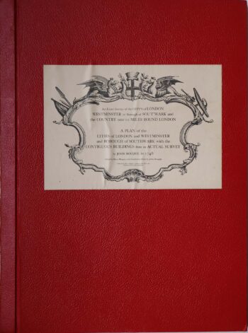
Facsimile of both Rocque’s 24 & 16-sheet map of London
£650ROCQUE, John.
Published In 1971
Stock No. 24478