- Reset all
- Argentina
- Austria
- Bering Strait
- Canada
- Canary Islands
- Devon
- Durham
- Eastern Europe
- Elba
- Georgia
- Hertfordshire
- Holy Land
- Indian Ocean
- Lancashire
- Latvia and Estonia
- London Localities
- Madeira
- Marche
- Martinique
- Morocco
- Netherlands
- North America Maps
- North Europe Maps
- Northamptonshire
- Nottinghamshire
- Piedmont
- Prints
- Russia
- Solar System
- Trentino
- United States
- Vietnam
- Views
- Westmorland
- World and Continents
- World Maps
Showing 529–539 of 539 results
-

Virginia & Florida
£1,350BLAEU, Willem Janszoon.
Published In 1647
Stock No. 10145 -

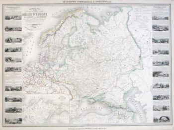
A large map of Northern Europe with vignettes
£220VUILLEMIN, Alexandre A.
Published In 1860
Stock No. 9549 -

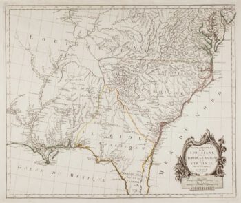
18th century map of the American South East
£500SANTINI, Francesco & Paolo.
Published In 1776
Stock No. 9346 -

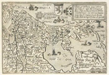
Holland
£400QUAD, Matthias.
Published In 1600
Stock No. 9094 -

The search for the North West Passage
£700MORTIER, Pierre.
Published In 1705
Stock No. 8709 -

Friesland
£250JANSSON, Jan.
Published In 1666
Stock No. 8433 -

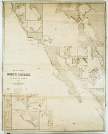
Blue-back chart of the West Coast of the USA
£950IMRAY, James.
Published In 1870
Stock No. 8360 -

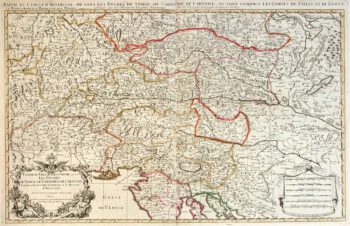
Two-sheet map of Austria
£350JAILLOT, Alexis-Hubert.
Published In 1705
Stock No. 8270 -

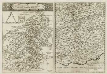
A scarce 16th century map of Piedmont and Berry
£1,100DE JODE, Gerard.
Published In 1593
Stock No. 7395 -

Rare map of the Bering Strait
£350CASSINI, Giovanni Maria.
Published In 1798
Stock No. 7375 -

A scarce world map after Giuseppe Rosaccio
£4,500ROSACCIO, Alovisio.
Published In 1610
Stock No. 22849