- Reset all
- Argentina
- Belgium
- Bering Strait
- Canary Islands
- Cape Verde Islands
- Chile
- Eastern Europe
- Georgia
- Great Lakes
- Gulf States
- Hertfordshire
- Holy Land
- Lancashire
- Latvia and Estonia
- Lincolnshire
- London Environs
- Madeira
- Mexico
- Morocco
- Netherlands
- North America Maps
- Northamptonshire
- Nottinghamshire
- Russia
- Solar System
- Southern Europe
- United States
- Vietnam
- Westmorland
- World and Continents
- World Maps
Showing 841–852 of 872 results
-

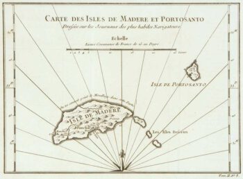
Madeira
£150BELLIN, Jacques-Nicolas.
Published In 1746
Stock No. 10178 -

Virginia & Florida
£1,350BLAEU, Willem Janszoon.
Published In 1647
Stock No. 10145 -

A romantic view of Venice by moonlight
£475BEEGER, Max & CHARPENTIER, A.
Published In 1850
Stock No. 10104 -

Campeche
£50ALLARD, Carel.
Published In 1720
Stock No. 9995 -

Early townplan of Sluis in Belgium
£220BRAUN, Georg & HOGENBERG, Frans.
Published In 1581
Stock No. 9914 -
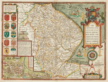
17th century English map of Lincolnshire
£800SPEED, John.
Published In 1676
Stock No. 9869 -

18th century prospect of Milan
£3,850WOLFF, Jeremias.
Published In 1725
Stock No. 9758 -

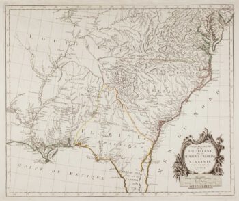
18th century map of the American South East
£500SANTINI, Francesco & Paolo.
Published In 1776
Stock No. 9346 -

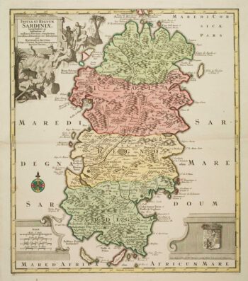
Large and detailed 18th century map of Sardinia
£750SEUTTER, Matthaus.
Published In 1730
Stock No. 9318 -
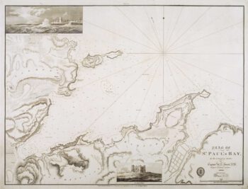
Chart of St Paul’s Bay, Malta
£490SMYTH, William Henry.
Published In 1855
Stock No. 9183 -

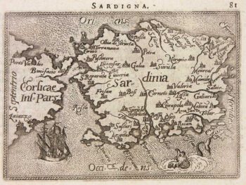
Miniature map of Sardinia
£155ORTELIUS, Abraham.
Published In 1602
Stock No. 9144 -

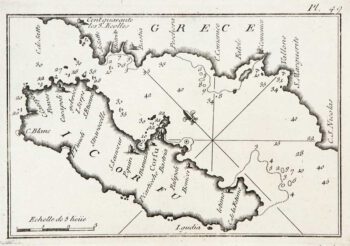
An 18th century chart of Corfu
£95ROUX, Joseph.
Published In 1764
Stock No. 9108