- Reset all
- Argentina
- Bering Strait
- Bolivia
- British Isles
- Canada
- Canary Islands
- Central Asia
- Devon
- Dorset
- Eastern Europe
- Eastern Seaboard Maps
- Ecuador
- Elba
- Georgia
- Gulf States
- Hertfordshire
- Lancashire
- Madeira
- Maritime
- Mauritius and Reunion
- Morocco
- Near East
- Netherlands
- North America Maps
- Northamptonshire
- Nottinghamshire
- Prints
- Russia
- Scottish Islands
- Solar System
- St Petersburg
- Surrey
- Switzerland
- Tibet
- Trentino
- United States
- Vietnam
- Virginia
- Westmorland
- World and Continents
- World Maps
Showing 901–912 of 924 results
-

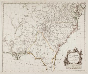
Virginia & Florida
£1,350BLAEU, Willem Janszoon.
Published In 1647
Stock No. 10145 -

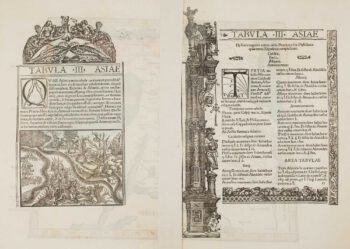
Ptolemaic map of the Caucasus
£700WALDSEEMULLER, Martin.
Published In 1535
Stock No. 9883 -

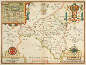
Speed’s county map of Radnor
£280SPEED, John.
Published In 1676
Stock No. 9874 -

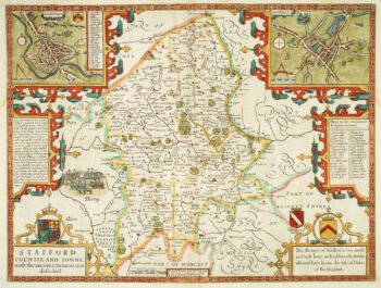
Staffordshire
£620SPEED, John.
Published In 1676
Stock No. 9870 -

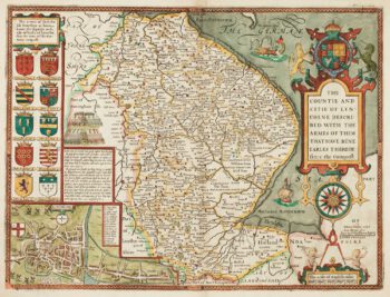
17th century English map of Lincolnshire
£800SPEED, John.
Published In 1676
Stock No. 9869 -

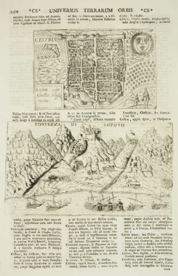
Chester
£50VALEGIO, Francesco & ROSACCIO, Guiseppe.
Published In 1713
Stock No. 9797 -

18th century map of the American South East
£500SANTINI, Francesco & Paolo.
Published In 1776
Stock No. 9346 -

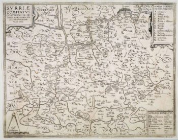
The so-called ‘Anonymous’ map of Surrey
£2,000SMITH, William.
Published In 1665
Stock No. 9177 -

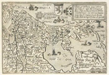
Holland
£400QUAD, Matthias.
Published In 1600
Stock No. 9094 -
The roads from Warrington to Chester and Manchester to Derby
£250OGILBY, John.
Published In 1675
Stock No. 9075 -

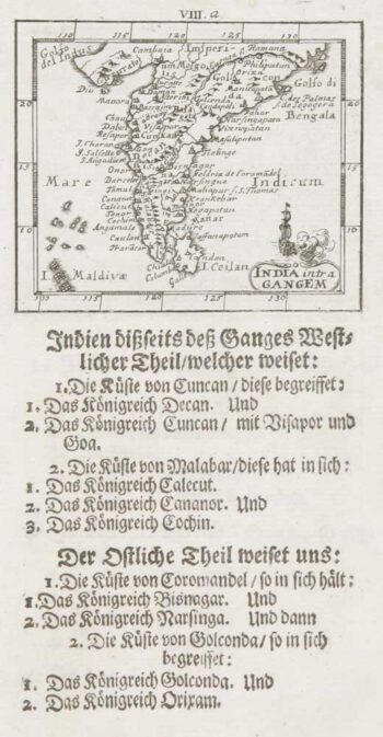
Uncommon miniature map of India
£140MULLER, Johann Ulrich.
Published In 1692
Stock No. 8921 -

The search for the North West Passage
£700MORTIER, Pierre.
Published In 1705
Stock No. 8709