- Reset all
- Argentina
- Bering Strait
- Burma
- Canada
- Canary Islands
- Devon
- Eastern Europe
- Elba
- Far East Maps
- France
- Gulf States
- Hertfordshire
- Holy Land
- Italian Islands
- Lancashire
- Latvia and Estonia
- Leinster
- Madeira
- Morocco
- Netherlands
- North America Maps
- Northamptonshire
- Portugal
- Prints
- Russia
- Solar System
- Surrey
- Tartary
- Trentino
- Ukraine
- United States
- Vietnam
- Westmorland
- World and Continents
Showing 565–575 of 575 results
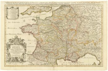
-

French Post Roads
£280LOTTER, Tobias Conrad.
Published In 1750
Stock No. 8713 -

The search for the North West Passage
£700MORTIER, Pierre.
Published In 1705
Stock No. 8709 -

A two-sheet map of France
£700JAILLOT, Alexis-Hubert.
Published In 1705
Stock No. 8440 -

Friesland
£250JANSSON, Jan.
Published In 1666
Stock No. 8433 -

Guyenne
£240JANSSON, Jan.
Published In 1666
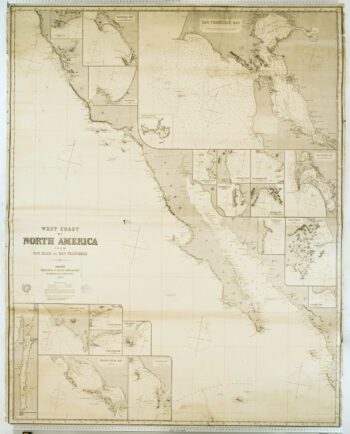
Stock No. 8391 -

Blue-back chart of the West Coast of the USA
£950IMRAY, James.
Published In 1870
Stock No. 8360 -

17th century Italian map of Tartary
£800DE ROSSI, Giovanni Giacomo.
Published In 1683
Stock No. 7687 -

An uncommon sea chart of France’s Mediterranean coast
£300LEVANTO, Francesco Maria.
Published In 1696
Stock No. 7408 -

Rare map of the Bering Strait
£350CASSINI, Giovanni Maria.
Published In 1798
Stock No. 7375 -

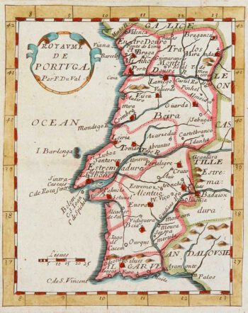
Miniature map of Portugal
£100DU VAL, Pierre.
Published In 1680
Stock No. 8134 -

17th century map of Portugal
£300DE WIT, Frederick.
Published In 1688
Stock No. 7672