Showing 1–12 of 97 results
-

A monumental sea chart of south-west England
£3,250HOOGHE, Romeyn de.
Published In 1693
Stock No. 24483 -

A rare 17th century Dutch sea chart of the British Isles
£1,400DONCKER, Hendrik.
Published In 1665
Stock No. 22272 -

18th century Italian map of Asia
£70TIRION, Isaak.
Published In 1740
Stock No. 24549 -

The first English atlas map of the Turkish Empire
£2,500SPEED, John.
Published In 1665
Stock No. 23981 -

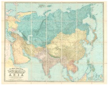
An early 20th century wall map of Asia
£825JOHNSTON, W. & A.K.
Published In 1907
Stock No. 24222 -

An 18th century two-sheet sea chart of the English Channel based on Halley
£1,250MOUNT & PAGE.
Published In 1745
Stock No. 23424 -

Classic carte-?-figure map of the Netherlands & Belgium
£1,300SPEED, John.
Published In 1665
Stock No. 23992 -

A very scarce Italian playing card of Asia
£350Anonymous.
Published In 1790
Stock No. 24231 -

A 16th century miniature map of Friesland
£65LANGENES, Barent.
Published In 1599
Stock No. 21166 -

A 16th century miniature map of Overijssel
£55LANGENES, Barent.
Published In 1599
Stock No. 21165 -

A 16th century miniature map of Gelderland
£70LANGENES, Barent.
Published In 1599
Stock No. 21164 -

A 16th century miniature map of Utrecht
£60LANGENES, Barent.
Published In 1599
Stock No. 21163