Showing 1–12 of 410 results
-

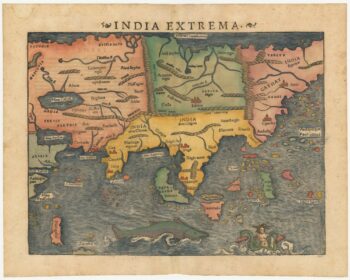
The first printed map of Asia
£1,850MUNSTER, Sebastian.
Published In 1572
Stock No. 24565 -

Munster’s classic woodcut map of Italy
£850MUNSTER, Sebastian.
Published In 1572
Stock No. 24562 -

The English edition of Du Halde’s map of Guangdong
£1,600DU HALDE, Johann Baptiste.
Published In 1738
Stock No. 24558 -

A classic 16th century Dutch map of Italy
£1,400ORTELIUS, Abraham.
Published In 1572
Stock No. 24552 -

A rare 18th century townplan of Worcester
£2,400YOUNG, George.
Published In 1780
Stock No. 24545 -

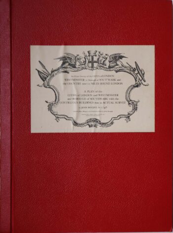
Facsimile of both Rocque’s 24 & 16-sheet map of London
£650ROCQUE, John.
Published In 1971
Stock No. 24478 -

16th century map of the Kingdom of Naples
£650ORTELIUS, Abraham.
Published In 1595
Stock No. 24444 -

A scarce 17th century prospect of Villefranche-sur-Mer
£1,500BLAEU, Johannes.
Published In 1682
Stock No. 24159 -

A 16th century Italian plan of Buda
£600VALEGIO, Francesco.
Published In 1598
Stock No. 24150 -

18th century decorative map of Italy
£550SEUTTER, Matth?us.
Published In 1740
Stock No. 24614 -

A late-Georgian map of the environs of London
£650CRUCHLEY, George Frederick.
Published In 1827
Stock No. 15495 -
A 16th century woodcut prospect of Rome
£400MUNSTER, Sebastian.
Published In 1572
Stock No. 24577