Showing 37–48 of 487 results
-

The First Edition of Ortelius’s map of the Spice Islands
£4,000ORTELIUS, Abraham.
Published In 1570
Stock No. 24431 -

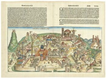
An incunable prospect of Jerusalem
£1,600SCHEDEL, D. Hartmann.
Published In 1493
Stock No. 24425 -

Victorian map of China with views of Hong Kong and Canton
£250TALLIS, John.
Published In 1851
Stock No. 23537 -

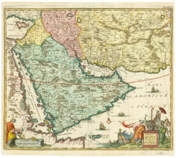
17th century map of Arabia
£1,000MEURS, Jacob van.
Published In 1680
Stock No. 20175 -

A late 18th century map of India.
£700MANNERT, Konrad.
Published In 1797
Stock No. 24481 -

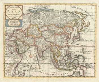
18th century Italian map of Asia
£70TIRION, Isaak.
Published In 1740
Stock No. 24549 -

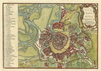
A late-18th century plan of Vienna
£230ANDREWS, John.
Published In 1800
Stock No. 24512 -

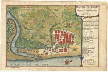
A plan of Puducherry at the beginning of the 18th century
£250FER, Nicolas de.
Published In 1705
Stock No. 24511 -

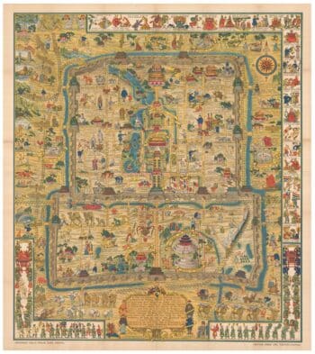
A pictorial map of Beijing in the 1930s
£3,000DORN, Frank.
Published In 1936
Stock No. 24392 -

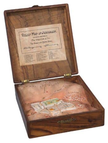
A plaster relief map of Jerusalem in a box
£1,200VESTER, Frederick.
Published In 1910
Stock No. 24365 -

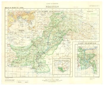
One of the first maps to show Pakistan as an independent state
£2,500SURVEY OF PAKISTAN.
Published In 1950
Stock No. 24297 -

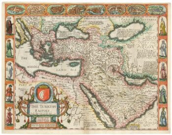
The first English atlas map of the Turkish Empire
£2,500SPEED, John.
Published In 1665
Stock No. 23981