Showing 1–12 of 90 results
-

Ortelius’s pocket atlas with the Galle maps in fine colour
£14,000ORTELIUS, Abraham.
Published In 1595
Stock No. 24476 -

Vrients’s scarce map of England, Wales & Ireland
£4,250VRIENTS, Jan Baptist.
Published In 1612
Stock No. 20271 -

A rare two volume geographical lexicon
£17,500LASOR A VAREA, Alphonsus.
Published In 1713
Stock No. 24516 -

A very fine early 19th century miniature atlas
£2,250REMONDINI, Giuseppe Antonio.
Published In 1801
Stock No. 24527 -

A scarce two-sheet map of England and Wales with side panels
£3,000WILLDEY, George.
Published In 1715
Stock No. 24165 -

A biography of Pope Pius V with a folding plate of the Battle of Lepanto
£3,000CATENA, Girolamo.
Published In 1647
Stock No. 24340 -

One of the largest printed prospects of Rome
£15,000VASI, Giuseppe.
Published In 1765
Stock No. 24364 -

A rare map of the Middle East, published by Lafreri
£27,500GASTALDI, Giacomo.
Published In 1561
Stock No. 23975 -

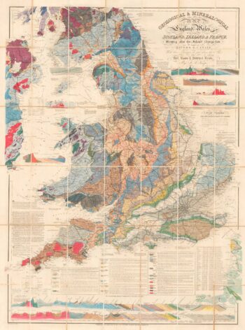
A detailed geological map of England and Wales
£1,500KNIPE, James Alexander.
Published In 1870
Stock No. 23418 -

Speed’s map of the wars of England
£1,800SPEED, John.
Published In 1665
Stock No. 23791 -

Miniature map of the East Midlands
£60PERROT, Aristide Michel.
Published In 1828
Stock No. 23304 -

England divided into the Saxon Heptarchy
£380SEUTTER, Matthaus.
Published In 1740
Stock No. 22311