Showing 1–12 of 1435 results
-

A geological map of the Duchy of Tyrol
£2,350STOTTER, Michael.
Published In 1851
Stock No. 23050 -

Ortelius’s pocket atlas with the Galle maps in fine colour
£14,000ORTELIUS, Abraham.
Published In 1595
Stock No. 24476 -

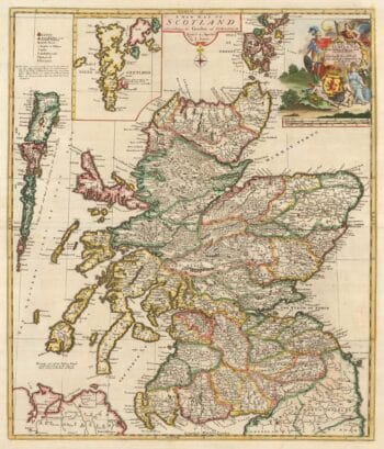
A scarce map of Scotland
£1,000BROWNE, Christopher.
Published In 1721
Stock No. 24436 -

Vrients’s scarce map of England, Wales & Ireland
£4,250VRIENTS, Jan Baptist.
Published In 1612
Stock No. 20271 -

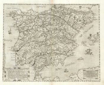
A two-sheet ‘Lafreri-School’ important map of Iberia
£9,750FORLANI, Paolo.
Published In 1567
Stock No. 24477 -

A 17th century chart of the eastern Mediterranean in fine colour.
£1,600DE WIT, Frederick.
Published In 1745
Stock No. 24490 -

de Hooghe’s spectacular chart of the Mediterranean Sea
£36,500HOOGHE, Romeyn de.
Published In 1694
Stock No. 24488 -

A monumental sea chart of south-west England
£3,250HOOGHE, Romeyn de.
Published In 1693
Stock No. 24483 -

Uncommon 16th century Italian map of Cyprus
£1,600ROSACCIO, Giuseppe.
Published In 1598
Stock No. 24538 -

A rare two volume geographical lexicon
£17,500LASOR A VAREA, Alphonsus.
Published In 1713
Stock No. 24516 -

A rare lifetime printing of Blaeu’s view of Vesuvius erupting in 1631
£1,400BLAEU, Johannes.
Published In 1663
Stock No. 24506 -

A monumental 18th century wall map of Switzerland on four sheets
£6,500SCHEUCHZER, Johann Jakob.
Published In 1712
Stock No. 24499