Showing 1–12 of 472 results
-

Ortelius’s pocket atlas with the Galle maps in fine colour
£14,000ORTELIUS, Abraham.
Published In 1595
Stock No. 24476 -

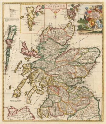
A scarce map of Scotland
£1,000BROWNE, Christopher.
Published In 1721
Stock No. 24436 -

Vrients’s scarce map of England, Wales & Ireland
£4,250VRIENTS, Jan Baptist.
Published In 1612
Stock No. 20271 -

A monumental sea chart of south-west England
£3,250HOOGHE, Romeyn de.
Published In 1693
Stock No. 24483 -

A rare two volume geographical lexicon
£17,500LASOR A VAREA, Alphonsus.
Published In 1713
Stock No. 24516 -

A very fine early 19th century miniature atlas
£2,250REMONDINI, Giuseppe Antonio.
Published In 1801
Stock No. 24527 -

An advert for an American railway
£750Anonymous.
Published In 1865
Stock No. 24455 -

An early 19th century map of Cornwall
£225CARY, John.
Published In 1805
Stock No. 24114 -

Russia, from the first English atlas of the World
£2,200SPEED, John.
Published In 1676
Stock No. 23731 -

A rare 17th century Dutch sea chart of the British Isles
£1,400DONCKER, Hendrik.
Published In 1665
Stock No. 22272 -

The founding of St Petersburg by Peter the Great
£700ZATTA, Antonio.
Published In 1797
Stock No. 24504 -

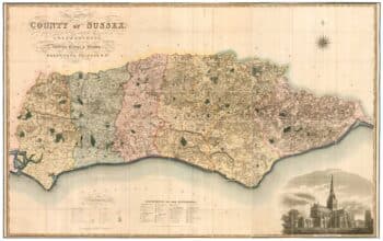
A large scale map of Sussex in fine colour
£2,800GREENWOOD, C. & J.
Published In 1825
Stock No. 24224