- Reset all
- Atlases
- Australia
- Bahamas
- Balearics
- Bohemia
- Calabria
- California
- Central Europe
- China
- Constellations
- Cornwall
- Corsica
- Essex
- Greece
- Hispaniola
- Hong Kong
- Ionian Islands
- Ischia
- Korea
- Maritime
- Mexico
- Monaco
- Moscow
- Norway
- Panama
- Paris
- Persia
- Prospects
- Provence
- Shropshire
- Somerset
- Syria
- Turkey
- Virgin Islands
- Warwickshire
Showing 1–12 of 434 results
-

The English edition of Du Halde’s map of Guangdong
£1,600DU HALDE, Johann Baptiste.
Published In 1738
Stock No. 24558 -

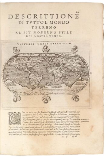
Magini’s edition of Ptolemy’s Geography
£6,000MAGINI, Giovanni Antonio.
Published In 1598
Stock No. 24449 -

Four scarce Italian playing cards depicting Norway
£850Anonymous.
Published In 1790
Stock No. 24246 -

A scarce 17th century prospect of Villefranche-sur-Mer
£1,500BLAEU, Johannes.
Published In 1682
Stock No. 24159 -

A 16th century Italian plan of Buda
£600VALEGIO, Francesco.
Published In 1598
Stock No. 24150 -

A 16th century woodcut map of Greece
£380MUNSTER, Sebastian.
Published In 1572
Stock No. 24576 -

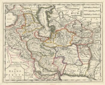
An 18th century Italian map of Persia
£300TIRION, Isaak.
Published In 1740
Stock No. 24550 -

18th century map of China
£320TIRION, Isaak.
Published In 1740
Stock No. 24547 -

John Oxley’s mapping of New South Wales
£280HALL, Sidney.
Published In 1828
Stock No. 24519 -

A 16th century town plan of Rhodes
£250ROTA, Martin.
Published In 1598
Stock No. 24199 -

A 16th century town plan of Corfu City
£250VALEGIO, Francesco.
Published In 1598
Stock No. 24181 -

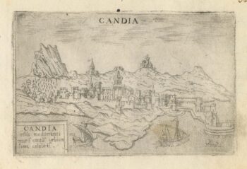
A 16th century town plan of Heraklion
£150VALEGIO, Francesco.
Published In 1598
Stock No. 24180