- Reset all
- Atlases
- Azores
- Balearics
- Balkan maps
- Black Sea
- Bolivia
- Buckinghamshire
- Burma
- Central Asia
- China
- Cornwall
- Cyprus
- Devon
- Florida
- Germany
- Gibraltar
- Globes and Instruments
- Greece
- Gulf States
- Indonesia
- Ionian Islands
- Lancashire
- Latvia and Estonia
- London Localities
- Madagascar
- Marche
- Maritime
- New York
- Panama
- Pennsylvania
- Rutland
- Scottish Islands
- Seychelles
- Southern Europe
- Suffolk
- Sussex
- Switzerland
- Tuscany
- Ukraine
- Umbria
- World
Showing 13–24 of 943 results
-

16th century map of the Kingdom of Naples
£650ORTELIUS, Abraham.
Published In 1595
Stock No. 24444 -

A 16th century Dutch map of Portugal
£700ORTELIUS, Abraham.
Published In 1595
Stock No. 24408 -

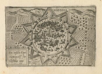
A 16th century town plan of Nicosia
£750VALEGIO, Francesco.
Published In 1598
Stock No. 24176 -

A rare 16th century Italian plan of Famagusta
£950VALEGIO, Francesco.
Published In 1598
Stock No. 24148 -

A miniature double-hemisphere world.
£600SANSON, Nicolas.
Published In 1735
Stock No. 22316 -
18th century decorative map of Italy
£550SEUTTER, Matth?us.
Published In 1740
Stock No. 24614 -

A 17th century map of of the Mogol Empire
£700CANTELLI DA VIGNOLA, Giacomo.
Published In 1683
Stock No. 24609 -

16th century Dutch map of Switzerland
£800ORTELIUS, Abraham.
Published In 1575
Stock No. 21809 -

Nash’s planned layout of Regent Street
£980LUFFMAN, John.
Published In 1814
Stock No. 18274 -

John Nash’s remodelling of St James’s Park
£950MOGG, Edward.
Published In 1827
Stock No. 18193 -
16th century woodblock map of Slovenia and Croatia
£375MUNSTER, Sebastian.
Published In 1572
Stock No. 24581 -

Munster’s map of the Iberian Peninsula
£400MUNSTER, Sebastian.
Published In 1572
Stock No. 24579