- Reset all
- Atlases
- Azores
- Balearics
- Balkan maps
- Bolivia
- Buckinghamshire
- Burma
- Central Asia
- Cyprus
- Devon
- Europe Continent
- Florida
- Germany
- Gibraltar
- Globes and Instruments
- Greece
- Gulf States
- Indonesia
- Ionian Islands
- Lancashire
- Latvia and Estonia
- Lincolnshire
- London Localities
- Map Games
- Marche
- Maritime
- New York
- Panama
- Pennsylvania
- Rutland
- Sardinia
- Scottish Islands
- Southern Europe
- Suffolk
- Sussex
- Switzerland
- Tuscany
- Ukraine
- Umbria
- World
Showing 817–828 of 902 results
-

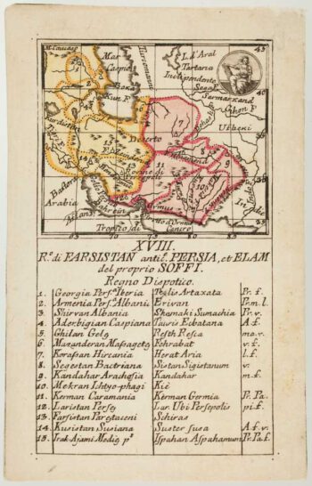
An 18th century playing-card map of Persia
£300RABATTA, Augusto & BAILOU, Jean Baptist de.
Published In 1779
Stock No. 13011 -

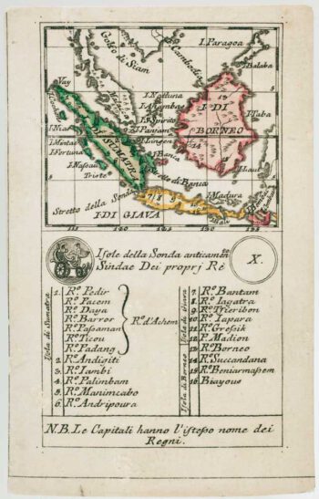
An 18th century playing-card map of Borneo & Sumatra
£250RABATTA, Augusto & BAILOU, Jean Baptist de.
Published In 1779
Stock No. 13010 -

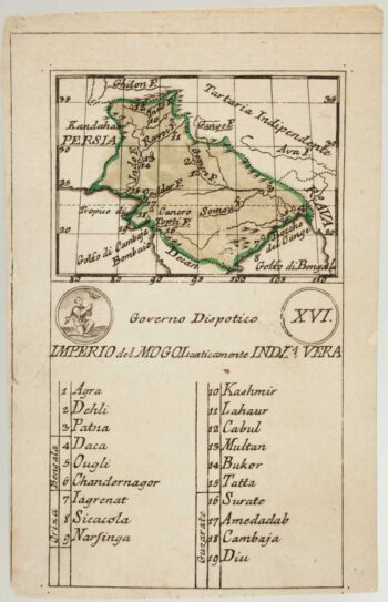
An 18th century playing-card map of the Mughal Empire
£200RABATTA, Augusto & BAILOU, Jean Baptist de.
Published In 1779
Stock No. 13009 -

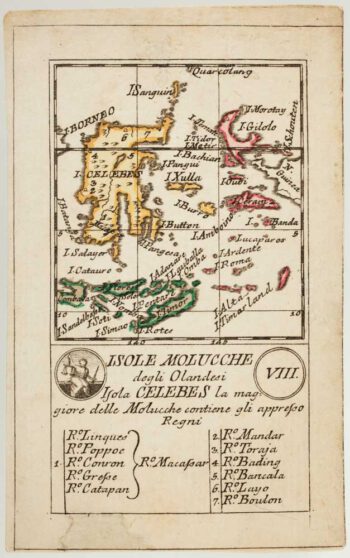
An 18th century playing-card map of Indonesia
£180RABATTA, Augusto & BAILOU, Jean Baptist de.
Published In 1779
Stock No. 13008 -

An 18th century playing-card map of India
£400RABATTA, Augusto & BAILOU, Jean Baptist de.
Published In 1779
Stock No. 12984 -

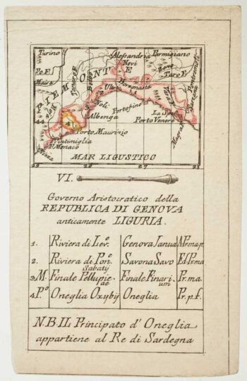
An 18th century playing-card map of Genoa
£250RABATTA, Augusto & BAILOU, Jean Baptist de.
Published In 1779
Stock No. 12971 -

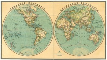
A late-19th century double-hemisphere world map in Cyrillic
£1,900IL'IN, A.
Published In 1890
Stock No. 19431 -

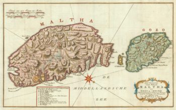
A military map of Malta from the mid-18th century
£680TIRION, Isaak.
Published In 1761
Stock No. 19418 -

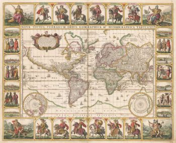
A world map with portraits of the Twelve Caesars
£20,000VISSCHER, Claes Janszoon.
Published In 1652
Stock No. 17720 -
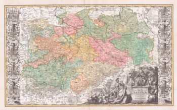
A scarce large-format map of Saxony in the 18th century
£1,800ZOLLMAN, Friedrich.
Published In 1731
Stock No. 17714 -

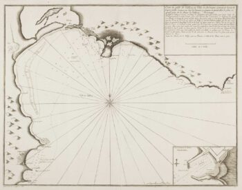
Scarce sea chart of Cagliari
£400AYROUARD, Jacques.
Published In 1732
Stock No. 14130 -

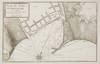
A scarce sea chart of Barcelona Harbour
£300AYROUARD, Jacques.
Published In 1746
Stock No. 14127