- Reset all
- Atlases
- Azores
- Balearics
- Bolivia
- Buckinghamshire
- Burma
- Cheshire
- China
- Cyprus
- Devon
- England and Wales
- Florida
- France
- Germany
- Gibraltar
- Globes and Instruments
- Greece
- Gulf States
- Indonesia
- Ionian Islands
- Lancashire
- Latvia and Estonia
- London Localities
- Madagascar
- Map Collecting
- Map Games
- Marche
- Maritime
- New York
- Northern Europe
- Northumberland
- Panama
- Pennsylvania
- Rutland
- Scottish Islands
- Southern Europe
- Suffolk
- Sussex
- Switzerland
- Tuscany
- Ukraine
- World
Showing 997–1008 of 1083 results
-

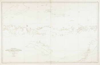
Sea chart of the Makassar Strait
£650BRYANT, Tomas.
Published In 1863
Stock No. 12464 -

Sea chart of the Lesser Sunda Islands
£500RIUDAVETS, José Maria.
Published In 1863
Stock No. 12460 -

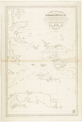
Sea chart of the Halmahera Sea, Indonesia
£700ESPEJO, José.
Published In 1843
Stock No. 12459 -

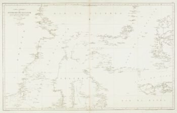
Sea chart of the Indonesian provinces of West & East Nusa Tenggara, with East Timor
£500BREGANTE, S.
Published In 1863
Stock No. 12458 -
Rare 19th centiury Spanish sea chart of China with Taiwan
£1,400FERREIRO, Martin
Published In 1863
Stock No. 12454 -

Sea chart of the East China Sea
£900BRYANT, Tomas.
Published In 1864
Stock No. 12452 -

Important French map of China by D’Anville
£900ANVILLE, Jean Baptiste B. D'.
Published In 1737
Stock No. 12227 -

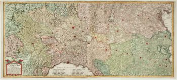
A two-sheet old map of the Po River
£1,300CERRUTI, Agostino.
Published In 1735
Stock No. 12221 -

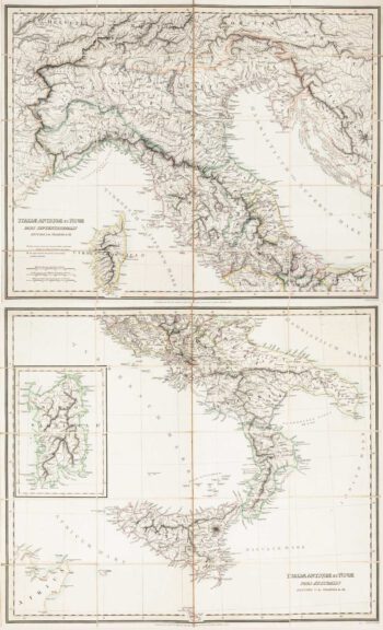
Two-sheet folding map of Italy
£650CRAMER. John Anthony.
Published In 1825
Stock No. 12143 -

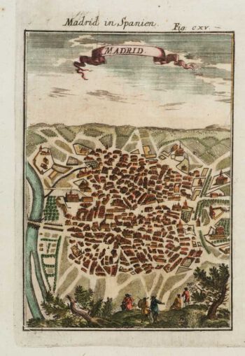
A 17th century prospect of Madrid
£150MALLET, Alain Manesson.
Published In 1684
Stock No. 12100 -

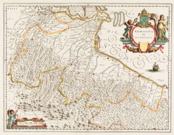
Classic 17th century Blaeu map of Romagna
£300BLAEU, Johannes.
Published In 1640
Stock No. 12069 -

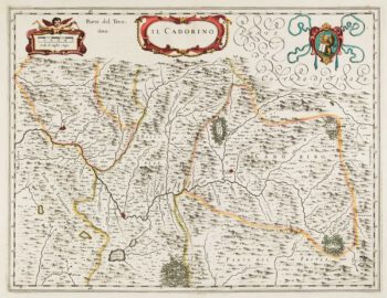
17th century map of Cadore
£200BLAEU, Johannes.
Published In 1640
Stock No. 12068