Showing 1–12 of 647 results
-

An early woodcut map of England
£1,000MUNSTER, Sebastian.
Published In 1572
Stock No. 24564 -

A late Victorian plan of Brighton.
£1,100TREACHER, H. & C.
Published In 1890
Stock No. 24546 -

A rare 18th century townplan of Worcester
£2,400YOUNG, George.
Published In 1780
Stock No. 24545 -

Magini’s edition of Ptolemy’s Geography
£6,000MAGINI, Giovanni Antonio.
Published In 1598
Stock No. 24449 -

Four scarce Italian playing cards depicting Norway
£850Anonymous.
Published In 1790
Stock No. 24246 -

A 16th century woodcut map of Greece
£380MUNSTER, Sebastian.
Published In 1572
Stock No. 24576 -

The uncommon Spanish edition of Blaeu’s map of Hertfordshire
£450BLAEU, Johannes.
Published In 1662
Stock No. 24521 -

Chart of the Zodiac sign Cancer
£275BLUNT, Charles F.
Published In 1845
Stock No. 24288 -
A 16th century town plan of Rhodes
£250ROTA, Martin.
Published In 1598
Stock No. 24199 -

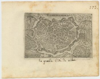
A 16th century town plan of Milan
£240VALEGIO, Francesco.
Published In 1598
Stock No. 24196 -

A 16th century town plan of Toledo
£250VALEGIO, Francesco.
Published In 1598
Stock No. 24189 -

A 16th century town plan of Santander
£260VALEGIO, Francesco.
Published In 1598
Stock No. 24188